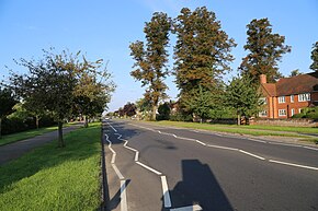
A1214 road
Appearance
| A1214 | |
|---|---|
 | |
| Route information | |
| Length | 9.4 mi (15.1 km) |
| Major junctions | |
| Southwest end | A12/A14 |
| A12 A14 | |
| East end | A12 |
| Location | |
| Country | United Kingdom |
| Primary destinations | Ipswich, Ipswich Hospital, Kesgrave, Martlesham |
| Road network | |
The A1214 is a 9.4 mile long 'A' road in the English county of Suffolk.[1] It links Central Ipswich to the A12 and A14 and passes Ipswich Hospital. Its midsection forms an outer ring road around the west and north of Ipswich.
Route
From west to east the road passes through the following settlements:
References
52°04′05″N 1°11′06″E / 52.06801°N 1.18487°E

