
Amy, Mississippi
Amy, Mississippi | |
|---|---|
 Amy  Amy | |
| Coordinates: 31°46′39″N 89°15′30″W / 31.77750°N 89.25833°W | |
| Country | United States |
| State | Mississippi |
| County | Jones |
| Elevation | 361 ft (110 m) |
| Time zone | UTC-6 (Central (CST)) |
| • Summer (DST) | UTC-5 (CDT) |
| Area codes | 601 & 769 |
| GNIS feature ID | 685444[1] |
Amy is an unincorporated community in Jones County, Mississippi. The community is located on Mississippi Highway 533, 1.7 miles (2.7 km) north-northeast of Soso.
In 1900, Amy had a post office and a population of 27.[2]
References
- ^ "Amy". Geographic Names Information System. United States Geological Survey, United States Department of the Interior.
- ^ Rowland, Dunbar (1907). Mississippi: Comprising Sketches of Counties, Towns, Events, Institutions, and Persons, Arranged in Cyclopedic Form. Vol. 1. Southern Historical Publishing Association. p. 113.
Municipalities and communities of Jones County, Mississippi, United States | ||
|---|---|---|
| Cities | 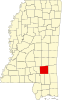 | |
| Towns | ||
| CDPs | ||
| Other communities | ||
| Indian reservation | ||
| Footnotes | ‡This populated place also has portions in an adjacent county or counties | |
This Jones County, Mississippi state location article is a stub. You can help Wikipedia by expanding it. |