Boelenslaan
Appearance
Boelenslaan
Boelensloane | |
|---|---|
Village | |
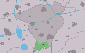
 Location in Achtkarspelen municipality | |
| Coordinates: 53°09′43″N 06°08′41″E / 53.16194°N 6.14472°E | |
| Country | |
| Province | |
| Municipality | |
| Population (January 2017) | |
| • Total | 1,141 |
| Time zone | UTC+1 (CET) |
| • Summer (DST) | UTC+2 (CEST) |
Boelenslaan (West Frisian: Boelensloane) is a small town in Achtkarspelen municipality in Friesland province in the northern Netherlands.
As of January 2017, Boelenslaan has 1141 inhabitants[1]
The village is in the "Friese Wouden" in the Frisian forests.
The Flag of Boelenslaan

The color red refers to the heathland and the severability fight of the population, the color yellow refers to the Sandgrounds. The color green refers to Friese Wouden, from the village area. The silver rose is the coat of arms of the noble family Boelens, after whom it was named.[2]
References
- ^ Villages - Achtkarspelen (in Dutch)
- ^ friesland-digitaal.eu In Dutch language, about the history of Boelenslaan
External links
![]() Media related to Boelenslaan at Wikimedia Commons
Media related to Boelenslaan at Wikimedia Commons


