Bonguéra
Bonguéra | |
|---|---|
Town and sub-prefecture | |
| Coordinates: 7°40′N 4°14′W / 7.667°N 4.233°W | |
| Country | |
| District | Lacs |
| Region | Iffou |
| Department | M'Bahiakro |
| Population (2014)[1] | |
| • Total | 18,560 |
| Time zone | UTC+0 (GMT) |
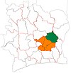
Bonguéra is a town in east-central Ivory Coast. It is a sub-prefecture of M'Bahiakro Department in Iffou Region, Lacs District.
Bonguéra was a commune until March 2012, when it became one of 1126 communes nationwide that were abolished.[2]
In 2014, the population of the sub-prefecture of Bonguéra was 18,560.[3]
Villages[edit]
The 20 villages of the sub-prefecture of Bonguéra and their population in 2014 are:[3]
- Anzandougou (300)
- Bédara (617)
- Bonguéra (3 146)
- Désidougou (820)
- Dondoni (791)
- Koffidougou (826)
- Konkidougou (977)
- Kossandougou (576)
- Kouakoudougou (1 617)
- Koumandougou (385)
- Krohoudougou (152)
- Manidougou (628)
- Moussobadougou (952)
- N'dodougou (445)
- Ouassadougou (2 671)
- Sandougou-Kossia (988)
- Sandougou-Kouma (753)
- Siaridougou (490)
- Tollédougou (289)
- Totodougou (1 136)
References[edit]
- ^ "Côte d'Ivoire". geohive.com. Retrieved 9 December 2015.
- ^ "Le gouvernement ivoirien supprime 1126 communes, et maintient 197 pour renforcer sa politique de décentralisation en cours", news.abidjan.net, 7 March 2012.
- ^ a b "RGPH 2014, Répertoire des localités, Région Iffou" (PDF). ins.ci. Retrieved 5 August 2019.


