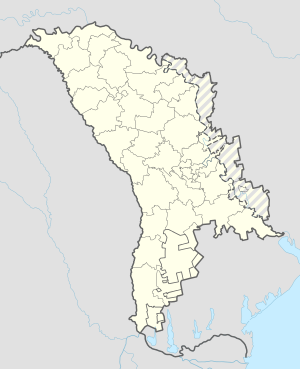
Bălănești, Nisporeni
Appearance
Bălănești | |
|---|---|
Commune | |
| Coordinates: 47°12′N 28°12′E / 47.200°N 28.200°E | |
| Country | |
| District | Nisporeni District |
| Population | |
| • Total | 2,170 |
| Time zone | UTC+2 (EET) |
| • Summer (DST) | UTC+3 (EEST) |
Bălănești is a commune in Nisporeni District, Moldova. It is composed of two villages, Bălănești and Găureni.[2]
The highest point of Moldova, Bălănești Hill,[3][4] is located in Bălănești.
Bălănești is the highest village in Moldova with an elevation of 324m.
References
- ^ Results of Population and Housing Census in the Republic of Moldova in 2014: "Characteristics - Population (population by communes, religion, citizenship)" (XLS). National Bureau of Statistics of the Republic of Moldova. 2017. Retrieved 2017-05-01.
- ^ Clasificatorul unităților administrativ-teritoriale al Republicii Moldova (CUATM) (in Romanian)
- ^ Rachier, V., Sobor, I., and Chiciuc, A. "Assessment of wind energy resource of Moldova", 2014
- ^ Şatravca, Elena "The capitalization of the tourist potential within the Central Moldova Plateau", Forum Geografic, 2014

