Càrn Mòr Dearg
| Càrn Mòr Dearg | |
|---|---|
 Càrn Mòr Dearg: seen from Ben Nevis | |
| Highest point | |
| Elevation | 1,223 m (4,012 ft)[1] |
| Prominence | 165 m (541 ft) |
| Parent peak | Ben Nevis |
| Listing | Munro, Marilyn |
| Naming | |
| English translation | Great red peak |
| Language of name | Gaelic |
| Pronunciation | Scottish Gaelic: [ˈkʰaːrˠn ˈmoːɾ ˈtʲɛɾɛk] English approx: kaarn maur jerek |
| Geography | |
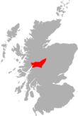
| Location | Lochaber, Scotland |
| OS grid | NN177722 |
| Topo map | OS Landranger 41 |
Càrn Mòr Dearg (1,221 m) is the eighth highest mountain in Scotland. It is situated in the west of Scotland, close to the town of Fort William, in Lochaber, Highland. It lies just to the north-west of its much more famous neighbour, Ben Nevis, to which it is linked by the spectacular Càrn Mòr Dearg Arête.
The ascent of Càrn Mòr Dearg from the north (start by golf course), the traverse of the arête, and the scramble up the north side of Ben Nevis make one of the best horse-shoe routes in Scotland.[2]
See also
References
- ^ "walkhighlands Carn Mor Dearg". walkhighlands.co.uk. 2013. Retrieved 22 November 2013.
- ^ Irvine Butterfield (1986). The High Mountains of Britain and Ireland. London: Diadem Books. p. 98. ISBN 0-906371-71-6.


