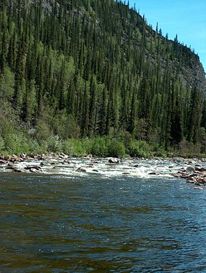
Charley River

The Charley River is a river in Alaska. It is a major tributary of the Yukon River. The Charley River watershed is forested chiefly with Black Spruce and White Spruce.[1] This general locus within the Yukon River catchment is the approximate westernmost limit of the Black Spruce, Picea mariana.[2] The river is located within the Yukon-Charley Rivers National Preserve, and forms part of the boundary between the Census Bureau's Southeast Fairbanks and Yukon-Koyukuk census areas.
See also
References
- J.G. Clough et al. 1995. Geological Map of the Charley Basin, Alaska Department of Fish and Game
- C. Michael Hogan. 2008. Black Spruce: Picea mariana, GlobalTwitcher.com, ed. Nicklas Stromberg
