Cominotto
Appearance
This article has multiple issues. Please help improve it or discuss these issues on the talk page. (Learn how and when to remove these messages)
|
Native name: Kemmunett | |
|---|---|
 Cominotto as seen from Comino | |
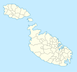
 Map of Comino. Cominotto is the small island on the left. | |
| Geography | |
| Location | off Comino, between Gozo and Malta, south of Sicily, Mediterranean Sea |
| Coordinates | 36°00′49″N 14°19′11.9″E / 36.01361°N 14.319972°E |
| Archipelago | Maltese Islands |
| Total islands | 7 |
| Major islands | 1 |
| Area | 0.25 km2 (0.097 sq mi) |
| Length | 396 m (1299 ft) |
| Width | 31.89–475.3 m (104.6–1,559.4 ft) |
| Coastline | 1.72 km (1.069 mi) |
| Highest elevation | 44 ft (13.4 m) |
| Administration | |
Malta | |
| Region | Gozo |
| Local council | Għajnsielem |
| Demographics | |
| Population | 0 |
Cominotto (Template:Lang-mt), sometimes referred to as Cominetto, is an uninhabited Mediterranean island off the northern coast of Malta.[1][2] Measuring only 0.25 square kilometres (0.10 sq mi) in area, it is the largest uninhabited island of Malta. Cominotto lies 100 metres (328 feet) to the north-west of Comino.
Between Comino and Cominotto lie the transparent, cyan waters of the Blue Lagoon (Maltese: Bejn il-Kmiemen, literally "Between the Cominos"). Frequented by large numbers of tourists and tour boats daily, the Blue Lagoon makes it popular with divers and snorkelers.[3]
-
The Blue Lagoon at sea level with Cominotto in the background
-
Cominotto and the Blue Lagoon
References
- ^ "Comino & Cominotto in Gozo". www.responsibletravel.com. Retrieved 2022-09-05.
- ^ "Attraction". Visit Malta. Retrieved 2022-09-05.
- ^ "Sailing directions for the Mediterranean: France, west coast of Italy, Corsica, Sardinia and Sicily, including adjacent islands". 1958.
Wikimedia Commons has media related to Cominotto (island).


