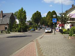
Diepenveen
Appearance
Diepenveen | |
|---|---|
 | |
| Country | Netherlands |
| Province | Overijssel |
| Municipality | Deventer |
| Population (1 January 2006) | 10.000 |
| Major roads | N337, N766 |


Diepenveen is a village in the eastern Netherlands. It is located in the municipality of Deventer, Overijssel, about 4 km north of the city centre.
Diepenveen was a separate municipality until 1999, when it became a part of Deventer.[1]
References
- ^ Ad van der Meer and Onno Boonstra, Repertorium van Nederlandse gemeenten, KNAW, 2011.
External links
- Template:Kuyper Map of the former municipality, around 1868.


