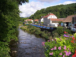
Doller (river)
| Doller | |
|---|---|
 | |
| Physical characteristics | |
| Mouth | Ill 47°45′56″N 7°19′51″E / 47.76556°N 7.33083°E |
| Length | 47 km (29 mi) |
The Doller is a river in Alsace (Haut-Rhin), in north-eastern France. It is a left tributary of the Ill (a tributary of the Rhine), in Mulhouse.
The source of the Doller is in the Vosges Mountains, east of the Ballon d'Alsace, at 940 metres (3,080 ft) elevation. It flows generally east, through the towns Sewen, Dolleren, Masevaux, Sentheim, Reiningue, before it enters the Ill in Mulhouse.
A "Doller" can also refer to a string, tied in the doll knot.
References
