El Pilar Fault System
Appearance

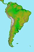
The El Pilar Fault System (Template:Lang-es) is a complex of geological faults located in state of Sucre in northern Venezuela. The fault system is of right-lateral strike-slip type and has an east–west orientation. Motion along the fault is largely transferred to the Warm Springs Fault in Trinidad Island.[1]
References
- ^ Audemard M., Franck A.; Singer P., André; Soulas, Jean-Pierre (2006). "Quaternary faults and stress regime of Venezuela" (PDF). Revista de la Asociación Geológica Argentina. 61 (4). Asociación Geológica Argentina: 480–491. Retrieved 24 November 2015.

