
File:113th US Congress House districts color.svg

Size of this PNG preview of this SVG file: 800 × 464 pixels. Other resolutions: 320 × 186 pixels | 640 × 372 pixels | 1,024 × 594 pixels | 1,280 × 743 pixels | 2,560 × 1,486 pixels | 1,242 × 721 pixels.
Original file (SVG file, nominally 1,242 × 721 pixels, file size: 3.9 MB)
| This is a file from the Wikimedia Commons. Information from its description page there is shown below. Commons is a freely licensed media file repository. You can help. |
Summary
| Description |
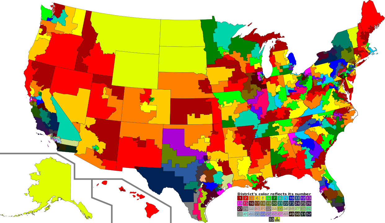
English: A map of all of the U.S. congressional districts (as of the 113th Congress). To find the district's number, look at the district, compare with the color code at the bottom to get number. The colors do not have any intrinsic meaning other than to provide visual distinction. |
| Date | |
| Source |
This file was derived from: |
| Author |
|
| SVG development |
Licensing
This file is licensed under the Creative Commons Attribution 3.0 Unported license.
- You are free:
- to share – to copy, distribute and transmit the work
- to remix – to adapt the work
- Under the following conditions:
- attribution – You must give appropriate credit, provide a link to the license, and indicate if changes were made. You may do so in any reasonable manner, but not in any way that suggests the licensor endorses you or your use.
Original upload log
This image is a derivative work of the following images:
- File:US Congressional Districts color.svg licensed with PD-self
- 2009-09-14T22:28:34Z Mr. Matté 2583x1557 (1299871 Bytes) Fix western CA districts
- 2009-07-17T15:45:17Z Mr. Matté 2583x1557 (1280927 Bytes) Fix NY 26/27, make one path --> text
- 2008-08-21T02:52:58Z Mr. Matté 2583x1557 (1306679 Bytes) Fix Hawaii
- 2008-04-16T02:38:02Z Mr. Matté 2583x1557 (1366638 Bytes) Higher-quality, smaller version of the colored congressional map by district number
- 2008-02-06T23:06:44Z Mr. Matté 9111x5493 (1961159 Bytes) {{Information |Description=A map of all of the [[:en:List of United States congressional districts|U.S. congressional districts]] (as of the [[:en:110th United States Congress|110th Congress]]). To find the district's number
- File:113th U.S. Congress House districts blank.svg licensed with Cc-zero
Uploaded with derivativeFX
File history
Click on a date/time to view the file as it appeared at that time.
| Date/Time | Thumbnail | Dimensions | User | Comment | |
|---|---|---|---|---|---|
| current | 03:02, 31 August 2012 | | 1,242 × 721 (3.9 MB) | Magog the Ogre | GA 02/08 accidentally transposed |
| 01:47, 31 August 2012 |  | 1,242 × 721 (3.9 MB) | Magog the Ogre | {{Information |Description={{en|1=A map of all of the U.S. congressional districts (as of the 113th Congress). To find the district's number, look at the distric... |
File usage
No pages on the English Wikipedia use this file (pages on other projects are not listed).
Global file usage
The following other wikis use this file:
- Usage on de.wikipedia.org
- Usage on fa.wikipedia.org
- Usage on fr.wikipedia.org
- Usage on nl.wikipedia.org
- Usage on sv.wikipedia.org