
File:17世紀アイヌ地図.png

Size of this preview: 800 × 566 pixels. Other resolutions: 320 × 226 pixels | 640 × 453 pixels | 1,024 × 724 pixels | 1,280 × 905 pixels | 1,753 × 1,240 pixels.
Original file (1,753 × 1,240 pixels, file size: 488 KB, MIME type: image/png)
| This is a file from the Wikimedia Commons. Information from its description page there is shown below. Commons is a freely licensed media file repository. You can help. |
Summary
| Description |
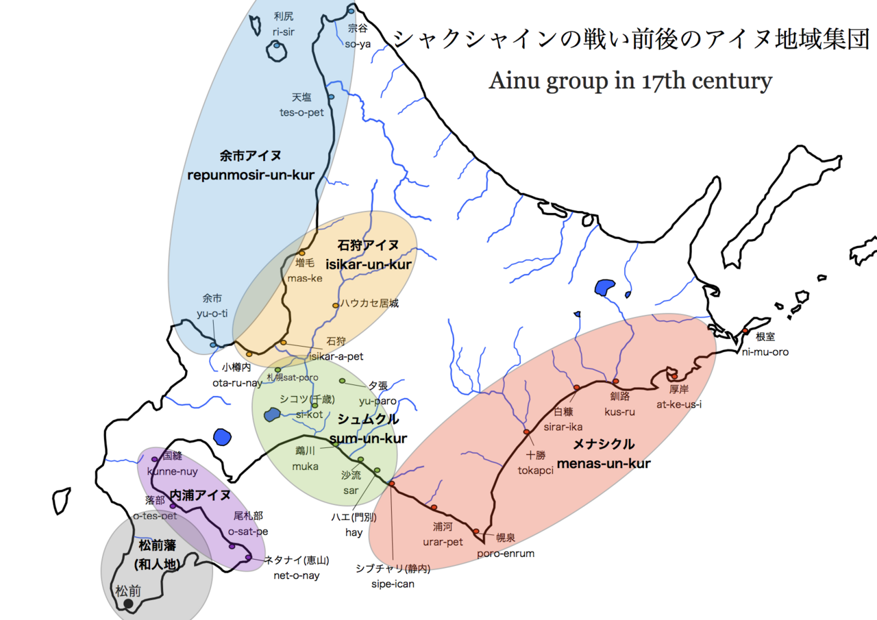
日本語: 田端宏・関口明・瀧澤正・桑原真人共著『アイヌ民族の歴史』山川出版社、2015年、81頁所載の地図を参考に作成した「シャクシャインの戦い前後のアイヌ地域集団」地図 |
| Date | |
| Source | Own work |
| Author | カラ |
Licensing
I, the copyright holder of this work, hereby publish it under the following license:
| This file is made available under the Creative Commons CC0 1.0 Universal Public Domain Dedication. | |
| The person who associated a work with this deed has dedicated the work to the public domain by waiving all of their rights to the work worldwide under copyright law, including all related and neighboring rights, to the extent allowed by law. You can copy, modify, distribute and perform the work, even for commercial purposes, all without asking permission.
|
File history
Click on a date/time to view the file as it appeared at that time.
| Date/Time | Thumbnail | Dimensions | User | Comment | |
|---|---|---|---|---|---|
| current | 12:35, 19 November 2023 | | 1,753 × 1,240 (488 KB) | カラ | Uploaded own work with UploadWizard |
File usage
No pages on the English Wikipedia use this file (pages on other projects are not listed).
Global file usage
The following other wikis use this file: