
File:African continent-en.svg

Size of this PNG preview of this SVG file: 635 × 600 pixels. Other resolutions: 254 × 240 pixels | 508 × 480 pixels | 813 × 768 pixels | 1,084 × 1,024 pixels | 2,169 × 2,048 pixels | 1,525 × 1,440 pixels.
Original file (SVG file, nominally 1,525 × 1,440 pixels, file size: 752 KB)
| This is a file from the Wikimedia Commons. Information from its description page there is shown below. Commons is a freely licensed media file repository. You can help. |
| Description |
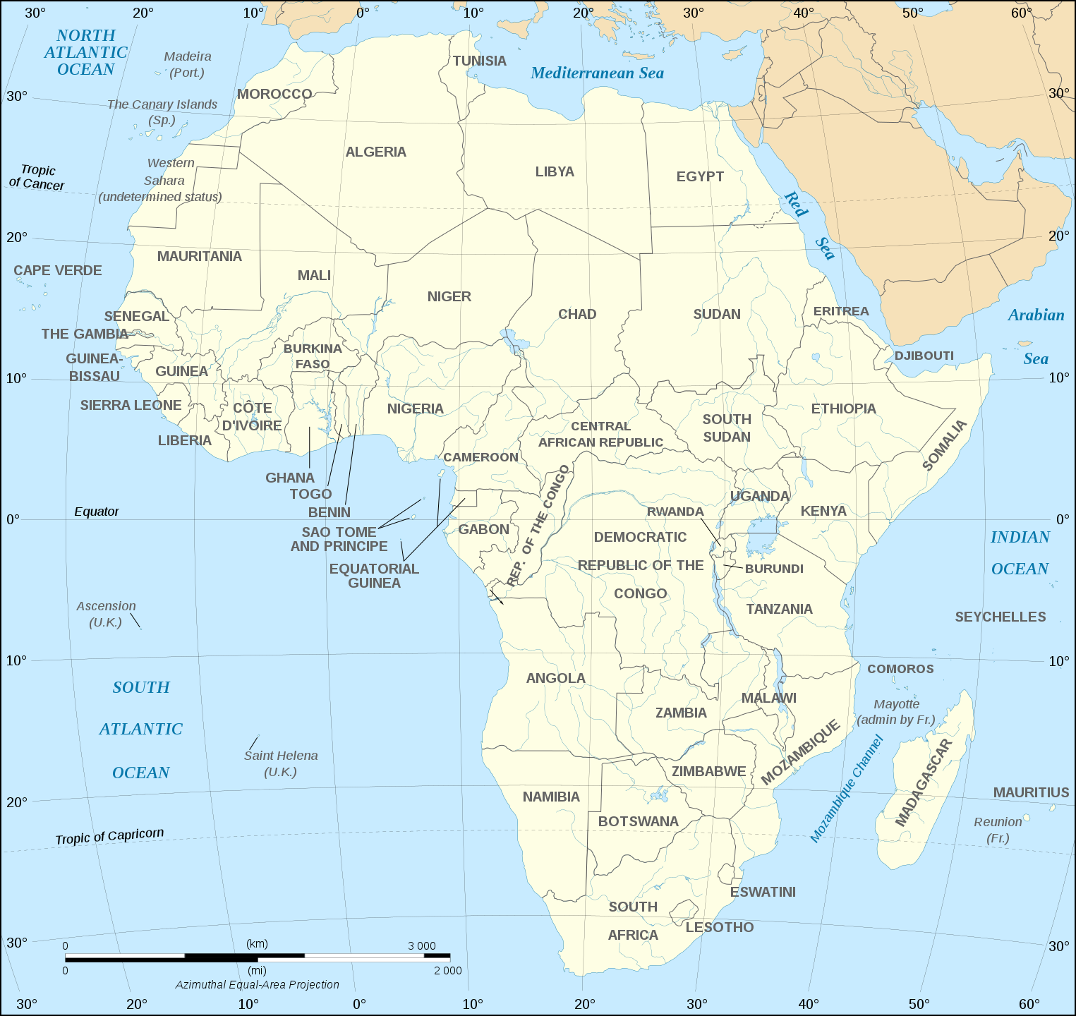
English: Map of the African continent as in 2011-07.
Français : Carte en anglais du continent africain tel qu'en 07/2011.
Lambert azimutal equal-area projection, WGS84 datum, standard meridian: 15°E, standard parallel: 0°Scale: 1:15,000,000 (accuracy: 3,75 km) |
||
| Date | (UTC), updated 2011-07 | ||
| Source | |||
| Author |
|
||
| Other versions |
Derivative works of this file:
[]
Map close to Africa map political-fr.svg, but with some changes on the islands administrated by European countries and the Sinai peninsula |
||
| SVG development |
|


I, the copyright holder of this work, hereby publish it under the following license:
This file is licensed under the Creative Commons Attribution-Share Alike 2.5 Generic, 2.0 Generic and 1.0 Generic license.
- You are free:
- to share – to copy, distribute and transmit the work
- to remix – to adapt the work
- Under the following conditions:
- attribution – You must give appropriate credit, provide a link to the license, and indicate if changes were made. You may do so in any reasonable manner, but not in any way that suggests the licensor endorses you or your use.
- share alike – If you remix, transform, or build upon the material, you must distribute your contributions under the same or compatible license as the original.
Original upload log
This image is a derivative work of the following images:
- Image:Africa_map_blank.svg licensed with Cc-by-sa-2.5,2.0,1.0, Cc-by-sa-2.5,2.0,1.0/en
- 2008-06-27T03:34:58Z Sting 1525x1440 (711453 Bytes) Completely new drawing with known projection
- 2006-05-31T15:28:42Z Sting 1390x1295 (571519 Bytes) Enhanced version : African and Asian continents separated
- 2006-05-31T03:53:32Z Sting 1390x1295 (566642 Bytes) {{Information |Description=Blank vector graphic map of [[:Category:Maps of Africa|Africa]] |Source=Several bitmap-type maps |Date= May 2006 |Author= Eric Gaba ({{U|Sting}}) |Permission=GFDL or CC-BY-SA |other_version
Uploaded with derivativeFX
File history
Click on a date/time to view the file as it appeared at that time.
| Date/Time | Thumbnail | Dimensions | User | Comment | |
|---|---|---|---|---|---|
| current | 18:21, 6 December 2020 | | 1,525 × 1,440 (752 KB) | Sting | Swatziland => eSwatini |
| 19:59, 14 July 2011 |  | 1,525 × 1,440 (752 KB) | Sting | Sudan/South Sudan 2011-07 border update | |
| 16:42, 16 December 2010 |  | 1,525 × 1,440 (747 KB) | Sting | Spelling correction: Madeira | |
| 20:16, 10 January 2009 |  | 1,525 × 1,440 (747 KB) | Sting | Correction Sao Tome | |
| 08:37, 6 December 2008 |  | 1,525 × 1,440 (750 KB) | Bobarino | {{Information |Description={{en|Map of the African continent.}} {{fr|Carte vierge du continent africain.}} Lambert azimutal equal-area projection, WGS84 datum, standard meridian: 15°E, standard pa |
File usage
The following pages on the English Wikipedia use this file (pages on other projects are not listed):
Global file usage
The following other wikis use this file:
- Usage on af.wikipedia.org
- Usage on ar.wikipedia.org
- Usage on azb.wikipedia.org
- Usage on az.wiktionary.org
- Usage on de.wikipedia.org
- Usage on fa.wikipedia.org
- Usage on hi.wikipedia.org
- Usage on hu.wikibooks.org
- Usage on id.wikipedia.org
- Usage on ig.wikipedia.org
- Usage on ilo.wikipedia.org
- Usage on ja.wikipedia.org
- Usage on ko.wikipedia.org
- Usage on www.mediawiki.org
- Usage on ml.wikipedia.org
- Usage on mn.wikipedia.org
- Usage on nl.wikipedia.org
- Usage on sd.wikipedia.org
- Usage on simple.wikipedia.org
- Usage on sw.wikipedia.org
- Usage on te.wikipedia.org
- Usage on th.wikipedia.org
- Usage on tly.wikipedia.org
- Usage on tr.wikipedia.org
- Usage on uz.wikipedia.org
- Usage on yo.wikipedia.org