
File:All Saints church, Graveney - geograph.org.uk - 145368.jpg
No higher resolution available.
All_Saints_church,_Graveney_-_geograph.org.uk_-_145368.jpg (640 × 480 pixels, file size: 125 KB, MIME type: image/jpeg)
| This is a file from the Wikimedia Commons. Information from its description page there is shown below. Commons is a freely licensed media file repository. You can help. |
Summary
| Description |
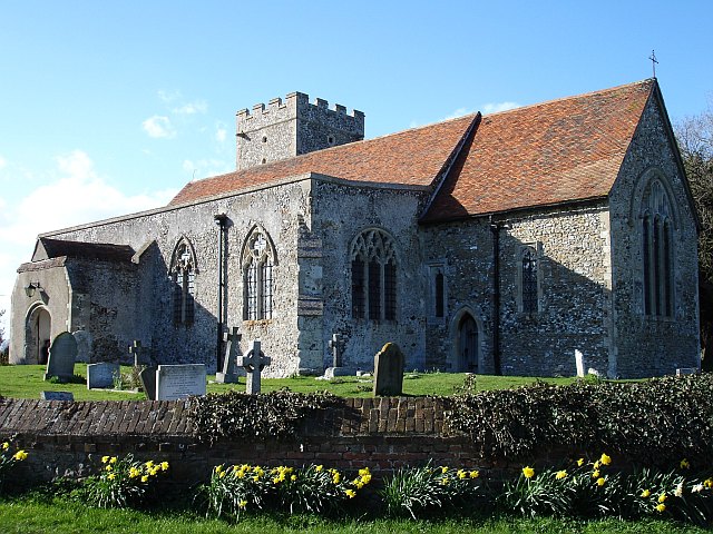
English: All Saints church, Graveney. The church stands next to a large farm and its associated cottages, the rest of this small community, including the primary school is about 200 metres down the road to the south. The whole community is surrounded by marsh, no longer tidal since the sea wall was built in 1325. The church stands about 12 metres above sea level and the land rises to the south and west. |
| Date | |
| Source | From geograph.org.uk |
| Author | Penny Mayes |
| Attribution (required by the license) | Penny Mayes / All Saints church, Graveney / |
| Camera location | | View this and other nearby images on: OpenStreetMap |
|---|
_heading:315.00&language=en)
| Object location | | View this and other nearby images on: OpenStreetMap |
|---|
_heading:315.00&language=en)
Licensing

|
This image was taken from the Geograph project collection. See this photograph's page on the Geograph website for the photographer's contact details. The copyright on this image is owned by Penny Mayes and is licensed for reuse under the Creative Commons Attribution-ShareAlike 2.0 license.
|
This file is licensed under the Creative Commons Attribution-Share Alike 2.0 Generic license.
Attribution: Penny Mayes
- You are free:
- to share – to copy, distribute and transmit the work
- to remix – to adapt the work
- Under the following conditions:
- attribution – You must give appropriate credit, provide a link to the license, and indicate if changes were made. You may do so in any reasonable manner, but not in any way that suggests the licensor endorses you or your use.
- share alike – If you remix, transform, or build upon the material, you must distribute your contributions under the same or compatible license as the original.
File history
Click on a date/time to view the file as it appeared at that time.
| Date/Time | Thumbnail | Dimensions | User | Comment | |
|---|---|---|---|---|---|
| current | 05:09, 31 January 2010 | | 640 × 480 (125 KB) | GeographBot | == {{int:filedesc}} == {{Information |description={{en|1=All Saints church, Graveney. The church stands next to a large farm and its associated cottages, the rest of this small community, including the primary school is about 200 metres down the road to t |
File usage
The following pages on the English Wikipedia use this file (pages on other projects are not listed):
Global file usage
The following other wikis use this file:
- Usage on cy.wikipedia.org
- Usage on de.wikipedia.org
- Usage on lld.wikipedia.org
- Usage on pl.wikipedia.org
- Usage on sv.wikipedia.org
- Usage on www.wikidata.org