
File:Altkirchen in ABG.png
No higher resolution available.
Altkirchen_in_ABG.png (299 × 299 pixels, file size: 5 KB, MIME type: image/png)
| This is a file from the Wikimedia Commons. Information from its description page there is shown below. Commons is a freely licensed media file repository. You can help. |
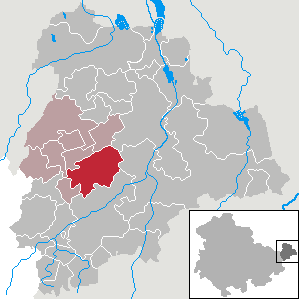
| Description | Altkirchen in Thuringia - District Altenburger Land | ||||||||
| Date | |||||||||
| Source | Own work | ||||||||
| Author | own work by Geograv | ||||||||
| Permission (Reusing this file) |
|

File history
Click on a date/time to view the file as it appeared at that time.
| Date/Time | Thumbnail | Dimensions | User | Comment | |
|---|---|---|---|---|---|
| current | 13:03, 6 July 2018 | | 299 × 299 (5 KB) | NordNordWest | upd |
| 18:47, 1 January 2013 |  | 299 × 299 (12 KB) | Lucas Friese | Gemeindegrenzen haben sich seit 2008 geändert | |
| 17:44, 28 November 2008 |  | 299 × 299 (5 KB) | Rauenstein | {{Information |Description= |Source= |Date= |Author= |Permission= |other_versions= }} | |
| 06:38, 11 February 2008 |  | 299 × 299 (5 KB) | Rauenstein | ||
| 14:35, 27 October 2007 |  | 299 × 299 (5 KB) | Rauenstein | {{Information |Description=Altkirchen in Thuringia - District Altenburger Land |Source=self |Date=2007-10-27 |Author=own work by Geograv |Permission= {{GFDL}} }} [[Category:Locator maps of municipalities in the |
File usage
No pages on the English Wikipedia use this file (pages on other projects are not listed).
Global file usage
The following other wikis use this file:
- Usage on de.wikipedia.org
- Usage on eo.wikipedia.org
- Usage on es.wikipedia.org
- Usage on eu.wikipedia.org
- Usage on fr.wikipedia.org
- Usage on hu.wikipedia.org
- Usage on mk.wikipedia.org
- Usage on nl.wikipedia.org
- Usage on pt.wikipedia.org
- Usage on ro.wikipedia.org
- Usage on sh.wikipedia.org
- Usage on sr.wikipedia.org
- Usage on tt.wikipedia.org
- Usage on uk.wikipedia.org
- Usage on vi.wikipedia.org
- Usage on www.wikidata.org