
File:Arcidiocesi di Ancona-Osimo.svg

Size of this PNG preview of this SVG file: 698 × 599 pixels. Other resolutions: 280 × 240 pixels | 559 × 480 pixels | 895 × 768 pixels | 1,193 × 1,024 pixels | 2,386 × 2,048 pixels | 2,749 × 2,360 pixels.
Original file (SVG file, nominally 2,749 × 2,360 pixels, file size: 111 KB)
| This is a file from the Wikimedia Commons. Information from its description page there is shown below. Commons is a freely licensed media file repository. You can help. |
Summary
| Description |
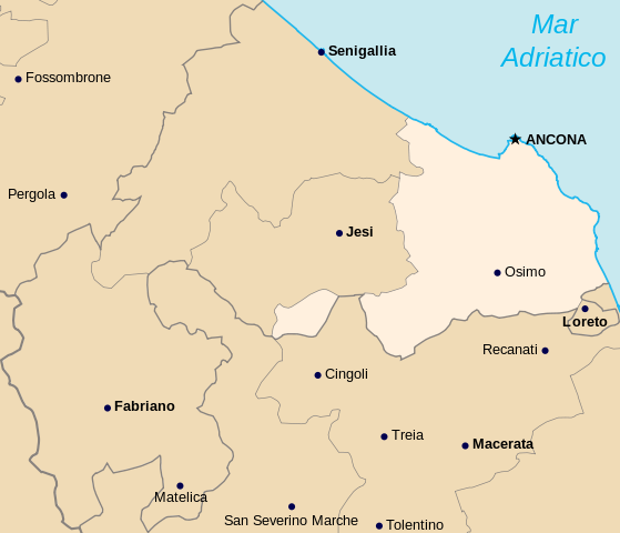
English: Map of the archdiocese of Ancona-Osimo
Italiano: Mappa dell'arcidiocesi di Ancona-Osimo |
| Date | |
| Source |
English: Derivative work from OpenStreetMap, released with CC-BY-SA-2.0 license Borders based on the official list of parishes provided by chiesacattolica.it
Italiano: Opera derivata dalle mappe di OpenStreetMap rilasciate con licenza CC-BY-SA-2.0 Confini basati sull'elenco ufficiale delle parrocchie di chiesacattolica.it |
| Author | Erinaceus |
This W3C-unspecified vector image was created with Inkscape .
Licensing
I, the copyright holder of this work, hereby publish it under the following licenses:
This file is licensed under the Creative Commons Attribution-Share Alike 3.0 Unported license.
- You are free:
- to share – to copy, distribute and transmit the work
- to remix – to adapt the work
- Under the following conditions:
- attribution – You must give appropriate credit, provide a link to the license, and indicate if changes were made. You may do so in any reasonable manner, but not in any way that suggests the licensor endorses you or your use.
- share alike – If you remix, transform, or build upon the material, you must distribute your contributions under the same or compatible license as the original.

|
Permission is granted to copy, distribute and/or modify this document under the terms of the GNU Free Documentation License, Version 1.2 or any later version published by the Free Software Foundation; with no Invariant Sections, no Front-Cover Texts, and no Back-Cover Texts. A copy of the license is included in the section entitled GNU Free Documentation License. |
You may select the license of your choice.
File history
Click on a date/time to view the file as it appeared at that time.
| Date/Time | Thumbnail | Dimensions | User | Comment | |
|---|---|---|---|---|---|
| current | 13:33, 4 November 2009 | | 2,749 × 2,360 (111 KB) | Actormusicus | adjusting borders for Fabriano-Matelica (frazione Domo) |
| 16:38, 2 October 2009 |  | 2,749 × 2,360 (111 KB) | Actormusicus | {{Information |Description={{en|1=Map of the archdiocese of Ancona-Osimo}} {{it|1=Mappa dell'arcidiocesi di Ancona-Osimo}} |Source={{own}} |Author=Erinaceus |Date=2009-10-02 |Permission= |other_versions= }} [[Category:Maps of Catholic |
File usage
The following pages on the English Wikipedia use this file (pages on other projects are not listed):
Global file usage
The following other wikis use this file:
- Usage on ca.wikipedia.org
- Usage on es.wikipedia.org
- Usage on fr.wikipedia.org
- Usage on id.wikipedia.org
- Usage on jv.wikipedia.org
- Usage on la.wikipedia.org
- Usage on nl.wikipedia.org