
File:Brazilian territories.svg

Size of this PNG preview of this SVG file: 800 × 406 pixels. Other resolutions: 320 × 162 pixels | 640 × 325 pixels | 1,024 × 520 pixels | 1,280 × 650 pixels | 2,560 × 1,299 pixels | 940 × 477 pixels.
Original file (SVG file, nominally 940 × 477 pixels, file size: 1.69 MB)
| This is a file from the Wikimedia Commons. Information from its description page there is shown below. Commons is a freely licensed media file repository. You can help. |
| This image was created / taken by João Felipe C.S. |
| Description |
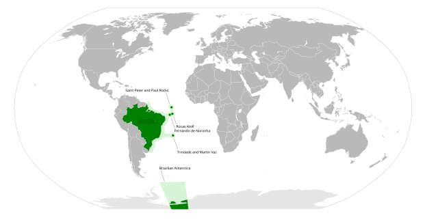
English: The Brazilian territories. (Brazilian Antarctica, Fernando de Noronha, Rocas Atoll, Saint Peter and Paul Rocks and Trindade and Martim Vaz)
Português: Os territórios brasileiros. (Antártica Brasileira, Atol das Rocas, Fernando de Noronha, Penedos de São Pedro e São Paulo e Trindade e Martim Vaz)
This W3C-unspecified vector image was created with Inkscape . |
||||||||
| Date | (UTC) | ||||||||
| Source | (Image:BlankMap-World6.svg) | ||||||||
| Author | Felipe Menegaz | ||||||||
| Permission (Reusing this file) |
I, Felipe Menegaz, the copyright holder of this work, hereby publishes it under the following licenses:
This file is licensed under the Creative Commons Attribution-Share Alike 2.5 Generic, 2.0 Generic and 1.0 Generic license. Attribution: I, Felipe Menegaz
You may select the license of your choice. |

File history
Click on a date/time to view the file as it appeared at that time.
| Date/Time | Thumbnail | Dimensions | User | Comment | |
|---|---|---|---|---|---|
| current | 03:41, 3 August 2008 | | 940 × 477 (1.69 MB) | Felipe Menegaz | {{Information |Description= |Source= |Date= |Author= |Permission= |other_versions= }} |
| 01:45, 2 August 2008 |  | 940 × 477 (1.66 MB) | Felipe Menegaz | {{Information |Description= |Source= |Date= |Author= |Permission= |other_versions= }} | |
| 20:18, 1 August 2008 |  | 940 × 477 (1.66 MB) | Felipe Menegaz | {{Information |Description= |Source= |Date= |Author= |Permission= |other_versions= }} | |
| 19:58, 1 August 2008 |  | 940 × 477 (1.66 MB) | Felipe Menegaz | {{Information |Description={{en|1=The Brazilian territories. <small>(Brazilian Antarctica, Fernando de Noronha, Rocas Atoll, Saint Peter and Paul Rocks and Trindade and Martim Vaz)</small>}} {{pt|1=Os territórios brasileiros. <small>(Antártica Brasileir |
File usage
No pages on the English Wikipedia use this file (pages on other projects are not listed).
Global file usage
The following other wikis use this file:
- Usage on ar.wikipedia.org
- Usage on ast.wikipedia.org
- Usage on da.wikipedia.org
- Usage on es.wikipedia.org
- Usage on he.wikipedia.org
- Usage on it.wikipedia.org
- Usage on ja.wikipedia.org
- Usage on pt.wikipedia.org
- Usage on zh.wikipedia.org