
File:Calvadnack and Farmland - geograph.org.uk - 159630.jpg
No higher resolution available.
Calvadnack_and_Farmland_-_geograph.org.uk_-_159630.jpg (640 × 427 pixels, file size: 119 KB, MIME type: image/jpeg)
| This is a file from the Wikimedia Commons. Information from its description page there is shown below. Commons is a freely licensed media file repository. You can help. |
Summary
| Description |
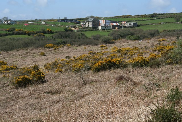
English: Calvadnack and Farmland Calvadnack is an area of open access heathland. There is a footpath marked on the OS map crossing it from north to south, however the footpath could not be found. The northern half of Calvadnack is used for rough cattle grazing and is passable but the vegetation makes the southern half unpassable, even in the springtime before the bracken has regrown. |
| Date | |
| Source | From geograph.org.uk |
| Author | Tony Atkin |
| Attribution (required by the license) | Tony Atkin / Calvadnack and Farmland / |
| Camera location | | View this and other nearby images on: OpenStreetMap |
|---|
_heading:270.00&language=en)
| Object location | | View this and other nearby images on: OpenStreetMap |
|---|
_heading:270.00&language=en)
Licensing

|
This image was taken from the Geograph project collection. See this photograph's page on the Geograph website for the photographer's contact details. The copyright on this image is owned by Tony Atkin and is licensed for reuse under the Creative Commons Attribution-ShareAlike 2.0 license.
|
This file is licensed under the Creative Commons Attribution-Share Alike 2.0 Generic license.
Attribution: Tony Atkin
- You are free:
- to share – to copy, distribute and transmit the work
- to remix – to adapt the work
- Under the following conditions:
- attribution – You must give appropriate credit, provide a link to the license, and indicate if changes were made. You may do so in any reasonable manner, but not in any way that suggests the licensor endorses you or your use.
- share alike – If you remix, transform, or build upon the material, you must distribute your contributions under the same or compatible license as the original.
File history
Click on a date/time to view the file as it appeared at that time.
| Date/Time | Thumbnail | Dimensions | User | Comment | |
|---|---|---|---|---|---|
| current | 06:51, 31 January 2010 | | 640 × 427 (119 KB) | GeographBot | == {{int:filedesc}} == {{Information |description={{en|1=Calvadnack and Farmland Calvadnack is an area of open access heathland. There is a footpath marked on the OS map crossing it from north to south, however the footpath could not be found. The north |
File usage
The following pages on the English Wikipedia use this file (pages on other projects are not listed):
Global file usage
The following other wikis use this file:
- Usage on www.wikidata.org