
File:Capitol Region incorporated and unincorporated areas Farmington highlighted.svg

Size of this PNG preview of this SVG file: 799 × 335 pixels. Other resolutions: 320 × 134 pixels | 640 × 268 pixels | 1,024 × 429 pixels | 1,280 × 537 pixels | 2,560 × 1,074 pixels | 1,550 × 650 pixels.
Original file (SVG file, nominally 1,550 × 650 pixels, file size: 756 KB)
| This is a file from the Wikimedia Commons. Information from its description page there is shown below. Commons is a freely licensed media file repository. You can help. |
Summary
| Description |
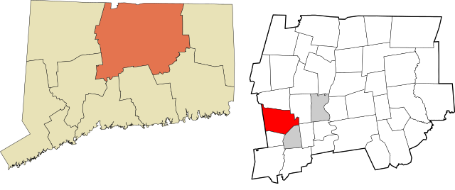
English: Map showing the location of this town/city within the Capitol Region, a planning region and county-equivalent of the U.S. state of Connecticut. Data source: the United States Census Bureau and File:Connecticut planning region map, cb 500k.svg. Made with Mapshaper (EPSG:2234) and Notepad++. |
| Date | |
| Source | Own work |
| Author | Twotwofourtysix |
Licensing
I, the copyright holder of this work, hereby publish it under the following license:
This file is licensed under the Creative Commons Attribution 4.0 International license.
- You are free:
- to share – to copy, distribute and transmit the work
- to remix – to adapt the work
- Under the following conditions:
- attribution – You must give appropriate credit, provide a link to the license, and indicate if changes were made. You may do so in any reasonable manner, but not in any way that suggests the licensor endorses you or your use.
File history
Click on a date/time to view the file as it appeared at that time.
| Date/Time | Thumbnail | Dimensions | User | Comment | |
|---|---|---|---|---|---|
| current | 15:48, 1 April 2023 | | 1,550 × 650 (756 KB) | Twotwofourtysix | Uploaded own work with UploadWizard |
File usage
The following pages on the English Wikipedia use this file (pages on other projects are not listed):
Global file usage
The following other wikis use this file:
- Usage on simple.wikipedia.org