
File:Cercanías Madrid2011v2.png

Size of this preview: 644 × 599 pixels. Other resolutions: 258 × 240 pixels | 516 × 480 pixels | 826 × 768 pixels | 1,101 × 1,024 pixels | 2,201 × 2,048 pixels | 3,515 × 3,270 pixels.
Original file (3,515 × 3,270 pixels, file size: 1.51 MB, MIME type: image/png)
| This is a file from the Wikimedia Commons. Information from its description page there is shown below. Commons is a freely licensed media file repository. You can help. |
Summary
| Description |
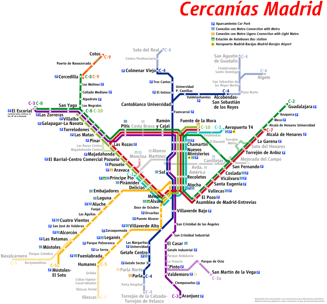
Español: Mapa de la red de Cercanías Madrid (a fecha de septiembre de 2011), con futuras ampliaciones English: Map of Madrid suburban rail network (as of September 2011), with future extensions |
| Date | |
| Source | Own work |
| Author | Assdl |
Licensing
I, the copyright holder of this work, hereby publish it under the following license:
This file is licensed under the Creative Commons Attribution-Share Alike 3.0 Unported license.
- You are free:
- to share – to copy, distribute and transmit the work
- to remix – to adapt the work
- Under the following conditions:
- attribution – You must give appropriate credit, provide a link to the license, and indicate if changes were made. You may do so in any reasonable manner, but not in any way that suggests the licensor endorses you or your use.
- share alike – If you remix, transform, or build upon the material, you must distribute your contributions under the same or compatible license as the original.
File history
Click on a date/time to view the file as it appeared at that time.
| Date/Time | Thumbnail | Dimensions | User | Comment | |
|---|---|---|---|---|---|
| current | 14:15, 22 September 2011 | | 3,515 × 3,270 (1.51 MB) | Assdl | Retoques menores. Ahora las líneas se ven más claras. |
| 13:34, 22 September 2011 |  | 3,515 × 3,270 (884 KB) | Assdl |
File usage
No pages on the English Wikipedia use this file (pages on other projects are not listed).
Global file usage
The following other wikis use this file:
- Usage on es.wikipedia.org