
File:Confederate Breastworks (2).JPG

Size of this preview: 800 × 533 pixels. Other resolutions: 320 × 213 pixels | 640 × 427 pixels | 1,024 × 683 pixels | 1,280 × 853 pixels | 2,560 × 1,707 pixels | 6,000 × 4,000 pixels.
Original file (6,000 × 4,000 pixels, file size: 12.01 MB, MIME type: image/jpeg)
| This is a file from the Wikimedia Commons. Information from its description page there is shown below. Commons is a freely licensed media file repository. You can help. |
.JPG)
Summary
| Description |
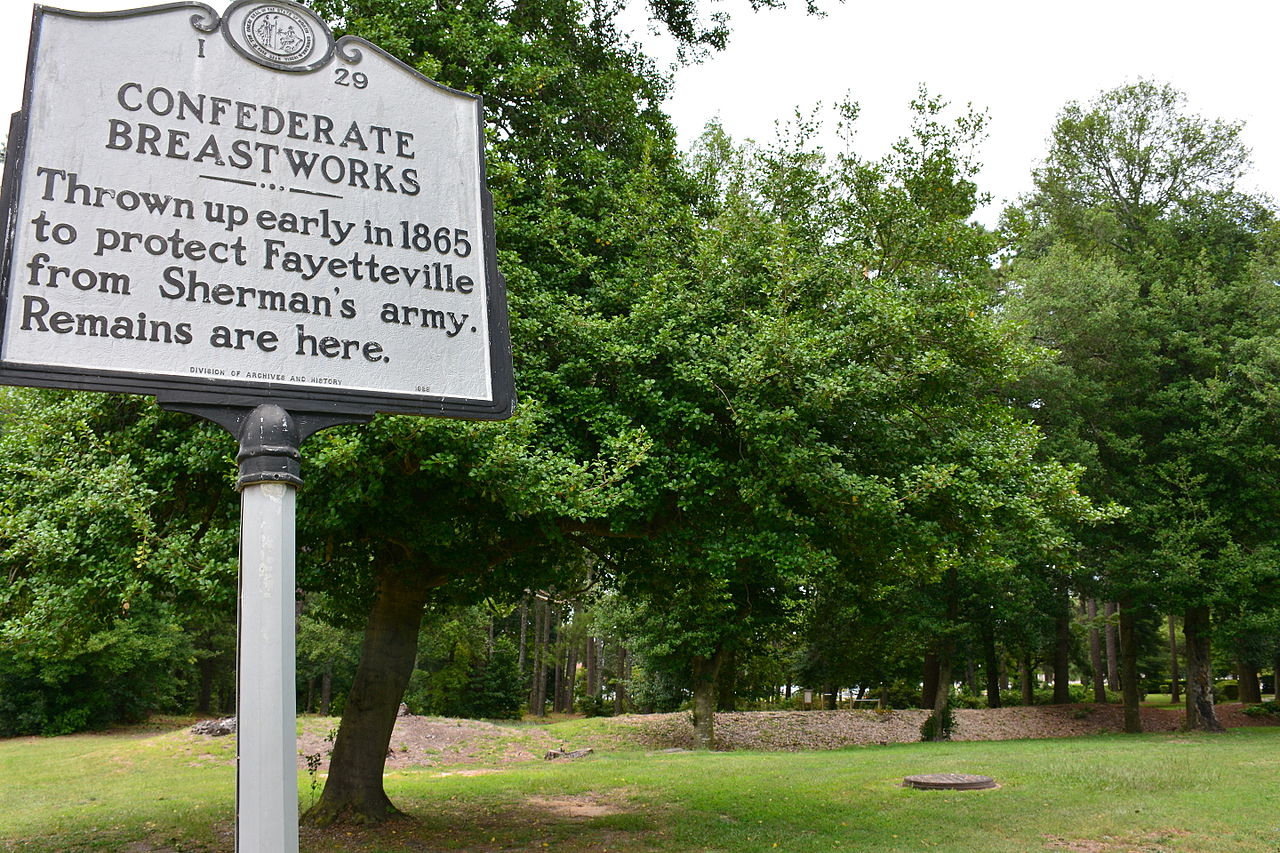
English: Confederate Breastworks The Confederate Breastworks, located at 2300 Ramsey Street in Fayetteville, Cumberland County, North Carolina, on the Veterans Administration Hospital property. The Breastworks were fortifications built on the north side of the city for the Confederacy to prevent Federal troops commanded by General William T. Sherman from taking an arsenal located in Fayetteville. It was believed that Sherman and his troops would travel up the Cape Fear River and invade Fayetteville from the north. On March 11, 1865, Sherman's army surprised the Confederate forces and invaded Fayetteville from the south.
|
||
| Date | |||
| Source | Own work | ||
| Author | Apc106 |
| Camera location | | View this and other nearby images on: OpenStreetMap |
|---|
.JPG¶ms=035.088688_N_-078.876130_E_globe:Earth_type:camera__&language=en)
Licensing
I, the copyright holder of this work, hereby publish it under the following license:
This file is licensed under the Creative Commons Attribution-Share Alike 3.0 Unported license.
- You are free:
- to share – to copy, distribute and transmit the work
- to remix – to adapt the work
- Under the following conditions:
- attribution – You must give appropriate credit, provide a link to the license, and indicate if changes were made. You may do so in any reasonable manner, but not in any way that suggests the licensor endorses you or your use.
- share alike – If you remix, transform, or build upon the material, you must distribute your contributions under the same or compatible license as the original.
File history
Click on a date/time to view the file as it appeared at that time.
| Date/Time | Thumbnail | Dimensions | User | Comment | |
|---|---|---|---|---|---|
| current | 23:11, 30 September 2015 | | 6,000 × 4,000 (12.01 MB) | Apc106 | User created page with UploadWizard |
File usage
The following pages on the English Wikipedia use this file (pages on other projects are not listed):
Global file usage
The following other wikis use this file:
- Usage on www.wikidata.org
.JPG)