
File:Darnestown-Seneca 1865.png
Size of this preview: 529 × 600 pixels. Other resolutions: 212 × 240 pixels | 423 × 480 pixels | 642 × 728 pixels.
Original file (642 × 728 pixels, file size: 956 KB, MIME type: image/png)
| This is a file from the Wikimedia Commons. Information from its description page there is shown below. Commons is a freely licensed media file repository. You can help. |
Summary
| Description |
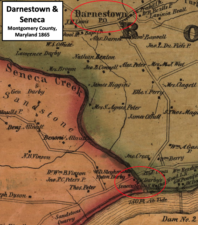
English: Map of portion of Montgomery County, Maryland, along Potomac River showing communities of Darnestown and Seneca in 1865. |
| Date | |
| Source | Library of Congress Label and circles added by TwoScarsUp. |
| Author | Martenet, Simon J.; Martenet & Bond; Schmidt & Trowe |

Licensing
|
This work is in the public domain in its country of origin and other countries and areas where the copyright term is the author's life plus 70 years or fewer. This work is in the public domain in the United States because it was published (or registered with the U.S. Copyright Office) before January 1, 1929. | |
| This file has been identified as being free of known restrictions under copyright law, including all related and neighboring rights. | |
File history
Click on a date/time to view the file as it appeared at that time.
| Date/Time | Thumbnail | Dimensions | User | Comment | |
|---|---|---|---|---|---|
| current | 15:42, 8 July 2021 | | 642 × 728 (956 KB) | TwoScarsUp | Uploaded a work by Martenet, Simon J.; Martenet & Bond; Schmidt & Trowe from {{Extracted from |Martenet and Bond's map of Montgomery County, Maryland LOC 2002620533.jpg}} [https://www.loc.gov/item/2002620533/ Library of Congress] Label and circles added by TwoScarsUp. with UploadWizard |
File usage
The following pages on the English Wikipedia use this file (pages on other projects are not listed):