File:Deutsches Reich (Karte) Hamburg.svg
Appearance

Size of this PNG preview of this SVG file: 650 × 545 pixels. Other resolutions: 286 × 240 pixels | 573 × 480 pixels | 916 × 768 pixels | 1,221 × 1,024 pixels | 2,443 × 2,048 pixels.
Original file (SVG file, nominally 650 × 545 pixels, file size: 1.04 MB)
File history
Click on a date/time to view the file as it appeared at that time.
| Date/Time | Thumbnail | Dimensions | User | Comment | |
|---|---|---|---|---|---|
| current | 07:53, 30 June 2007 |  | 650 × 545 (1.04 MB) | N3MO | |
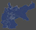
| 14:28, 30 July 2006 |  | 650 × 545 (797 KB) | David Liuzzo | {{Information| |Description= {{de|Karte des Deutschen Reiches zu Anbeginn des 20. Jahrhunderts. Neben den einzelnen Gliedstaaten sind auch die preußischen Provinzen auf der Karte verzeichnet. Die Lage der freien Hansestadt Hamburg ist hervorgehoben.}} |S |
File usage
No pages on the English Wikipedia use this file (pages on other projects are not listed).
Global file usage
The following other wikis use this file:
- Usage on fr.wikipedia.org

