
File:Europa 1400.jpg
Original file (3,054 × 2,436 pixels, file size: 2.01 MB, MIME type: image/jpeg)
| This is a file from the Wikimedia Commons. Information from its description page there is shown below. Commons is a freely licensed media file repository. You can help. |
_en.png)
.png)
.jpg)
| Description |
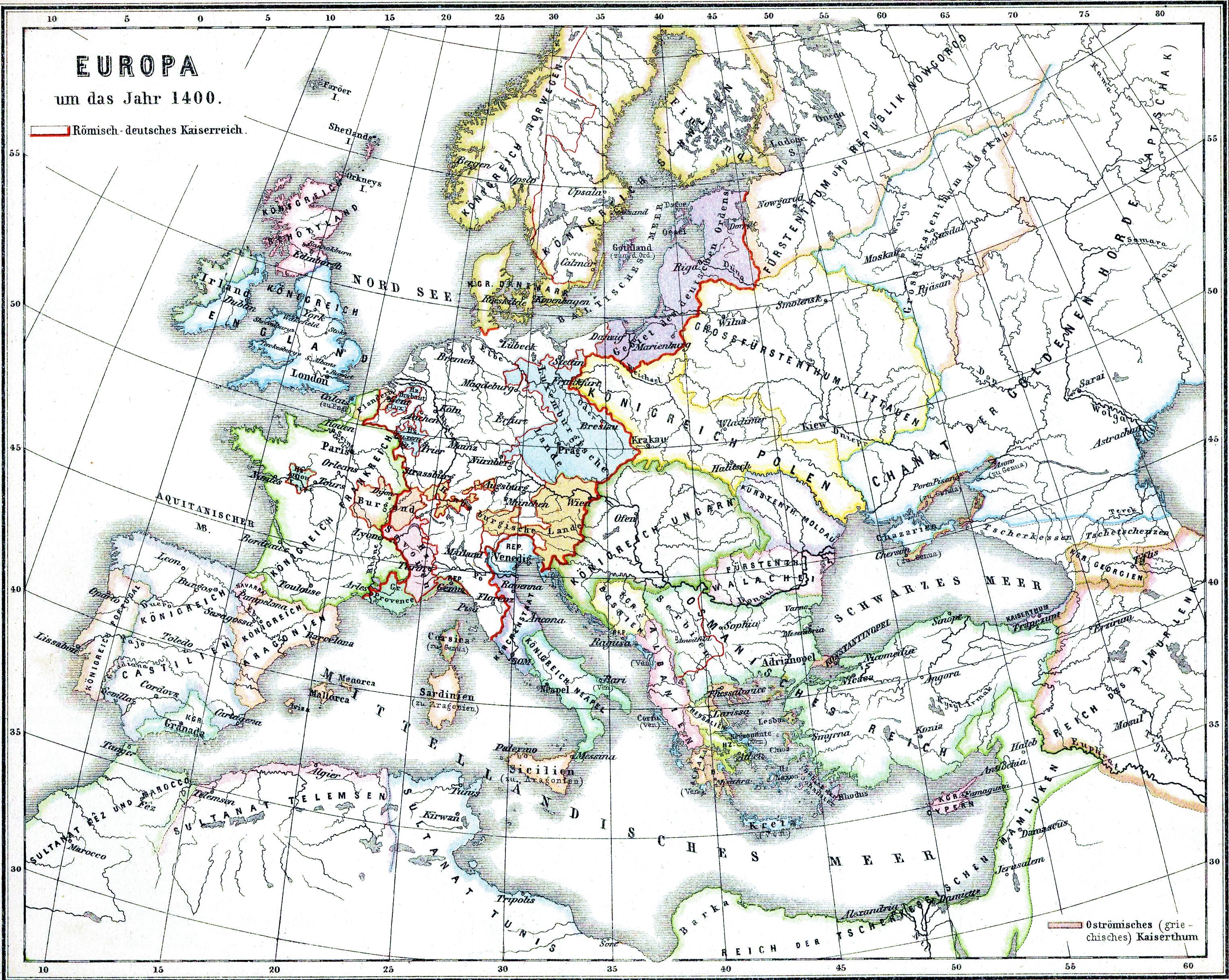
Deutsch: Europa im Jahre 1400 |
| Date | |
| Source | Historischer Schulatlas. |
| Author | H.Kiepert |
|
This work is in the public domain in its country of origin and other countries and areas where the copyright term is the author's life plus 70 years or fewer.
| |
| This file has been identified as being free of known restrictions under copyright law, including all related and neighboring rights. | |
File history
Click on a date/time to view the file as it appeared at that time.
| Date/Time | Thumbnail | Dimensions | User | Comment | |
|---|---|---|---|---|---|
| current | 16:35, 28 April 2009 | | 3,054 × 2,436 (2.01 MB) | Alex:D | whitened |
| 18:03, 16 February 2009 |  | 3,054 × 2,436 (2.99 MB) | Olahus | {{Information |Description={{de|Europa im Jahre 1400}} |Source=Historischer Schulatlas. |Date=1879 |Author=H.Kiepert |Permission= |other_versions= }} {{PD-old}} Category:Maps in German Category:Old maps of Europe [[Category:Maps showing history o |
File usage
Global file usage
The following other wikis use this file:
- Usage on ba.wikipedia.org
- Usage on ce.wikipedia.org
- Usage on cs.wikipedia.org
- Usage on cv.wikipedia.org
- Usage on frr.wikipedia.org
- Usage on ja.wikipedia.org
- Usage on no.wikipedia.org
- Antikken
- Den industrielle revolusjon
- Renessansen
- Vikingtiden
- Den kalde krigen
- Middelalderen
- Wikipedia:Maler/Historie
- Europas historie
- Senmiddelalderen
- Mal:Europas historie
- Folkevandringstiden
- Høymiddelalderen
- Tidlig middelalder
- Europeisk kolonisering
- Portal:Den kalde krigen
- Tidlig moderne tid
- Europas historie 1789–1914
- Renessanse og reformasjon i Europa
- Bruker:Andreas Kolle/sandkasse
- Motreformasjon og religionskrig (1556–1648)
- Opplyst enevelde i Europa
- Usage on pt.wikipedia.org
- Usage on ro.wikipedia.org
- Usage on ru.wikipedia.org
- Usage on tt.wikipedia.org
- Usage on vi.wikipedia.org