
File:FortProctorLongViewShellBeach.jpg
No higher resolution available.
FortProctorLongViewShellBeach.jpg (503 × 232 pixels, file size: 46 KB, MIME type: image/jpeg)
| This is a file from the Wikimedia Commons. Information from its description page there is shown below. Commons is a freely licensed media file repository. You can help. |
Summary
| Description |
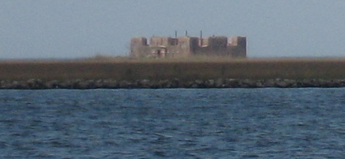
English: {| cellspacing="0" style="text-align: left; color: #000; background: #f9f9f9; border:4px solid #b28000; solid #bbb; margin: 1px;" class="layouttemplate" lang="en" dir="auto"
| style="width:22px; height:22px;" | SummaryView of Fort Proctor as seen in distance across the Mississippi River Gulf Outlet Canal from Shell Beach by Yscloskey, Louisiana. |
| Source | Own work |
| Author | Infrogmation |
Licensing
I, the copyright holder of this work, hereby publish it under the following licenses:

|
Permission is granted to copy, distribute and/or modify this document under the terms of the GNU Free Documentation License, Version 1.2 or any later version published by the Free Software Foundation; with no Invariant Sections, no Front-Cover Texts, and no Back-Cover Texts. A copy of the license is included in the section entitled GNU Free Documentation License. |
This file is licensed under the Creative Commons Attribution 2.5 Generic license.
- You are free:
- to share – to copy, distribute and transmit the work
- to remix – to adapt the work
- Under the following conditions:
- attribution – You must give appropriate credit, provide a link to the license, and indicate if changes were made. You may do so in any reasonable manner, but not in any way that suggests the licensor endorses you or your use.
You may select the license of your choice.
| Object location | | View this and other nearby images on: OpenStreetMap |
|---|
File history
Click on a date/time to view the file as it appeared at that time.
| Date/Time | Thumbnail | Dimensions | User | Comment | |
|---|---|---|---|---|---|
| current | 03:19, 4 April 2006 | | 503 × 232 (46 KB) | Infrogmation | View of Fort Proctor as seen in distance across the Mississippi River Gulf Outlet Canal from Shell Beach by Yscloskey, Louisiana. Photo by ~~~ Category:Fort Proctor |
File usage
The following pages on the English Wikipedia use this file (pages on other projects are not listed):
Global file usage
The following other wikis use this file:
- Usage on ja.wikipedia.org