
File:Historicalcapitalsofchina ancient.png
Size of this preview: 563 × 599 pixels. Other resolutions: 225 × 240 pixels | 451 × 480 pixels | 721 × 768 pixels | 1,080 × 1,150 pixels.
Original file (1,080 × 1,150 pixels, file size: 176 KB, MIME type: image/png)
| This is a file from the Wikimedia Commons. Information from its description page there is shown below. Commons is a freely licensed media file repository. You can help. |
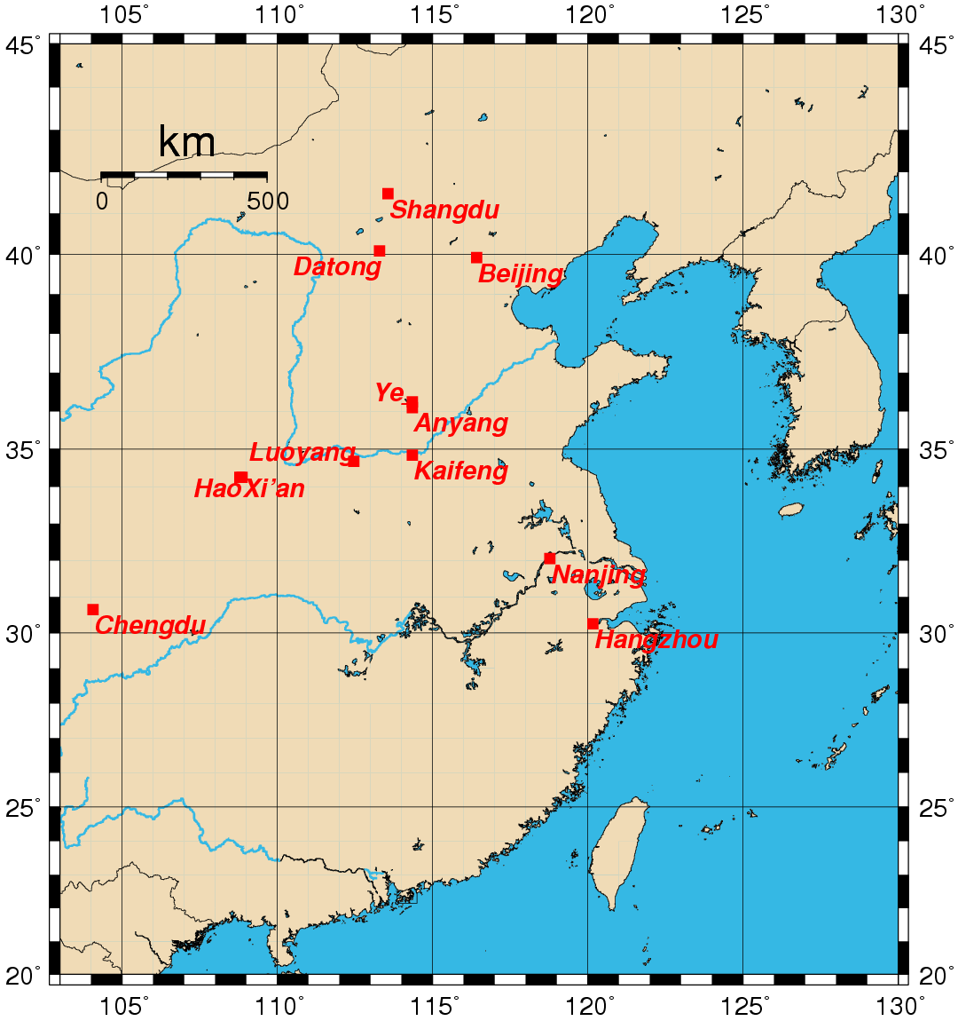
This image was copied from wikipedia:en. The original description was:
Map showing the location of the historical capitals of China in use prior to the 20th century. Map created by Rolf Müller using the Generic Mapping Tools (GMT).
Geographical coordinates (latitude, longitude) used:
- Anyang 36.1000 114.3500
- Beijing 39.9166 116.4166
- Chengdu 30.6500 104.0666
- Datong 40.0833 113.3000
- Hangzhou 30.2500 120.1666
- Hao 34.2500 108.8000
- Kaifeng 34.8500 114.3500
- Luoyang 34.6833 112.4666
- Nanjing 32.0500 118.7833
- Shangdu 41.4833 113.5666
- Xi'an 34.2500 108.8666
- Ye 36.2500 114.3500
External link

|
Permission is granted to copy, distribute and/or modify this document under the terms of the GNU Free Documentation License, Version 1.2 or any later version published by the Free Software Foundation; with no Invariant Sections, no Front-Cover Texts, and no Back-Cover Texts. A copy of the license is included in the section entitled GNU Free Documentation License. |
| This file is licensed under the Creative Commons Attribution-Share Alike 3.0 Unported license. | ||
| ||
| This licensing tag was added to this file as part of the GFDL licensing update. |
| date/time | username | edit summary |
|---|---|---|
| 00:02, 25 August 2005 | Rolfmueller | (19th -> 20th century division) |
| 00:14, 24 August 2005 | Rolfmueller | (add links & coordinates) |
| 00:14, 24 August 2005 | Rolfmueller | (add links & coordinates) |
| 11:44, 23 August 2005 | Rolfmueller | (image information added) |
| 11:36, 23 August 2005 | Rolfmueller | (uploaded {{GFDL}}) |
File history
Click on a date/time to view the file as it appeared at that time.
| Date/Time | Thumbnail | Dimensions | User | Comment | |
|---|---|---|---|---|---|
| current | 07:53, 23 October 2005 | | 1,080 × 1,150 (176 KB) | ChongDae | This image was copied from wikipedia:en. The original description was: Map showing the location of the historical capitals of China in use prior to the 20th century. Map created by Rolf Müller using the Generic Ma |
File usage
The following pages on the English Wikipedia use this file (pages on other projects are not listed):
Global file usage
The following other wikis use this file:
- Usage on cs.wikipedia.org
- Usage on de.wikipedia.org
- Usage on es.wikipedia.org
- Usage on fr.wikipedia.org
- Usage on hy.wikipedia.org
- Usage on id.wikipedia.org
- Usage on it.wikipedia.org
- Usage on ko.wikipedia.org
- Usage on pnb.wikipedia.org
- Usage on ru.wikipedia.org
- Usage on uk.wikipedia.org
- Usage on ur.wikipedia.org