
File:Ireland map County Tipperary small.png
No higher resolution available.
Ireland_map_County_Tipperary_small.png (130 × 98 pixels, file size: 3 KB, MIME type: image/png)
| This is a file from the Wikimedia Commons. Information from its description page there is shown below. Commons is a freely licensed media file repository. You can help. |
Summary
| Description |
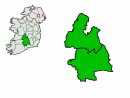
English: Demonstration map of County Tipperary map with inset location on island of Ireland. See Image:Ireland_map_County_Tipperary.png for larger version. |
| Source | Zoney (talk) (Uploads) |
| Author | Zoney (talk) (Uploads) |
Licensing
| This file is licensed under the Creative Commons Attribution-Share Alike 3.0 Unported license. Subject to disclaimers. | ||
| ||
| This licensing tag was added to this file as part of the GFDL licensing update. |

|
Permission is granted to copy, distribute and/or modify this document under the terms of the GNU Free Documentation License, Version 1.2 or any later version published by the Free Software Foundation; with no Invariant Sections, no Front-Cover Texts, and no Back-Cover Texts. A copy of the license is included in the section entitled GNU Free Documentation License. Subject to disclaimers. |
File history
Click on a date/time to view the file as it appeared at that time.
| Date/Time | Thumbnail | Dimensions | User | Comment | |
|---|---|---|---|---|---|
| current | 19:59, 4 November 2004 | | 130 × 98 (3 KB) | Zoney | Demonstration map of County Tipperary map with inset location on island of Ireland. See Image:Ireland_map_County_Tipperary.png for larger version. {{GFDL}} |
File usage
The following pages on the English Wikipedia use this file (pages on other projects are not listed):