
File:Kilbaha village - welcome - geograph.org.uk - 1882563.jpg
No higher resolution available.
Kilbaha_village_-_welcome_-_geograph.org.uk_-_1882563.jpg (640 × 426 pixels, file size: 222 KB, MIME type: image/jpeg)
| This is a file from the Wikimedia Commons. Information from its description page there is shown below. Commons is a freely licensed media file repository. You can help. |
Summary
| Description |
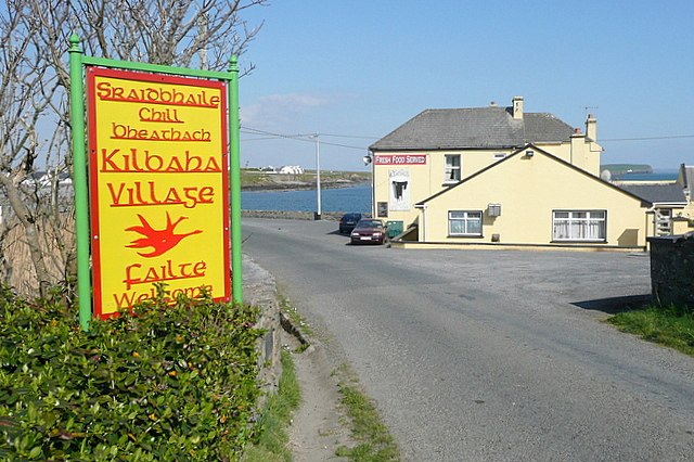
English: Kilbaha village - welcome, near to Kiltrellig, Bridge of Ross, Ross, Fodry and Cill Bheathach, Clare, Ireland.
At first I thought it ought to say "welcome back" as this is the last village on the Loop Head peninsula and we are approaching from the west. But there is another lane to the head that bypasses Kilbaha so there might just be someone arriving from this direction who has not been to Kilbaha before. In front of the bay is one of two pubs in the village. |
| Date | |
| Source | From geograph.org.uk; transferred by User:Lvova using geograph_org2commons. |
| Author | Graham Horn |
| Permission (Reusing this file) |
Creative Commons Attribution Share-alike license 2.0 |
| Attribution (required by the license) | Graham Horn / Kilbaha village - welcome / |
| Camera location | | View this and other nearby images on: OpenStreetMap |
|---|
| Object location | | View this and other nearby images on: OpenStreetMap |
|---|
_region:IE_heading:22.00&language=en)
Licensing

|
This image was taken from the Geograph project collection. See this photograph's page on the Geograph website for the photographer's contact details. The copyright on this image is owned by Graham Horn and is licensed for reuse under the Creative Commons Attribution-ShareAlike 2.0 license.
|
This file is licensed under the Creative Commons Attribution-Share Alike 2.0 Generic license.
Attribution: Graham Horn
- You are free:
- to share – to copy, distribute and transmit the work
- to remix – to adapt the work
- Under the following conditions:
- attribution – You must give appropriate credit, provide a link to the license, and indicate if changes were made. You may do so in any reasonable manner, but not in any way that suggests the licensor endorses you or your use.
- share alike – If you remix, transform, or build upon the material, you must distribute your contributions under the same or compatible license as the original.
File history
Click on a date/time to view the file as it appeared at that time.
| Date/Time | Thumbnail | Dimensions | User | Comment | |
|---|---|---|---|---|---|
| current | 14:45, 4 February 2011 | | 640 × 426 (222 KB) | File Upload Bot (Magnus Manske) |
File usage
The following pages on the English Wikipedia use this file (pages on other projects are not listed):
Global file usage
The following other wikis use this file:
- Usage on eo.wikipedia.org
- Usage on eu.wikipedia.org
- Usage on fr.wikipedia.org
- Usage on ga.wikipedia.org
- Usage on nl.wikipedia.org
- Usage on www.wikidata.org