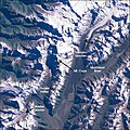
File:Landsat Mt Cook Region closeup.jpg
Appearance
Landsat_Mt_Cook_Region_closeup.jpg (540 × 540 pixels, file size: 128 KB, MIME type: image/jpeg)
File history
Click on a date/time to view the file as it appeared at that time.
| Date/Time | Thumbnail | Dimensions | User | Comment | |
|---|---|---|---|---|---|
| current | 12:42, 19 May 2006 |  | 540 × 540 (128 KB) | Avenue | == Summary == {{Information| |Description=This true-color image from Landsat points out features of the Mount Cook region in the South Island of New Zealand. |Source=[http://earthobservatory.nasa.gov/Newsroom/NewImages/images.php3?img_id=15331 NASA's Eart |
File usage
The following page uses this file:
Global file usage
The following other wikis use this file:
- Usage on fr.wikipedia.org
- Usage on it.wikipedia.org
- Usage on pt.wikipedia.org


