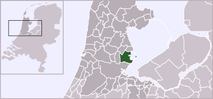
File:LocatieWaterland.png
Appearance
LocatieWaterland.png (421 × 196 pixels, file size: 40 KB, MIME type: image/png)
File history
Click on a date/time to view the file as it appeared at that time.
| Date/Time | Thumbnail | Dimensions | User | Comment | |
|---|---|---|---|---|---|
| current | 19:08, 3 February 2012 |  | 421 × 196 (40 KB) | Gladiool | Increased size + 2012 municipality borders |
| 01:11, 15 August 2005 |  | 280 × 130 (9 KB) | Nimix13 | {{Information| |Description = Location of Waterland |Source = own drawing |Date = 25 Jan. 2004 |Author = :nl:Gebruiker:Mtcv |Permission = first upload to nl: 25 jan 2004 21:21 by :nl:Gebruiker:Mtcv |other_versions = }} {{PD}} Category:Maps |
File usage
The following page uses this file:
Global file usage
The following other wikis use this file:
- Usage on bg.wikipedia.org
- Usage on br.wikipedia.org
- Usage on da.wikipedia.org
- Usage on de.wikipedia.org
- Usage on es.wikipedia.org
- Usage on fa.wikipedia.org
- Usage on fr.wikipedia.org
- Usage on fy.wikipedia.org
- Usage on id.wikipedia.org
- Usage on it.wikipedia.org
- Usage on jv.wikipedia.org
- Usage on li.wikipedia.org
- Usage on pt.wikipedia.org
- Usage on ro.wikipedia.org
- Usage on simple.wikipedia.org
- Usage on sv.wikipedia.org
- Usage on tr.wikipedia.org
- Usage on uk.wikipedia.org
- Usage on www.wikidata.org

