
File:LouisXIV maps1700 Bruxelles.jpg
Size of this preview: 750 × 599 pixels. Other resolutions: 301 × 240 pixels | 601 × 480 pixels | 961 × 768 pixels | 1,280 × 1,023 pixels | 2,560 × 2,045 pixels | 6,447 × 5,151 pixels.
Original file (6,447 × 5,151 pixels, file size: 4.78 MB, MIME type: image/jpeg)
| This is a file from the Wikimedia Commons. Information from its description page there is shown below. Commons is a freely licensed media file repository. You can help. |
Summary
| Description |
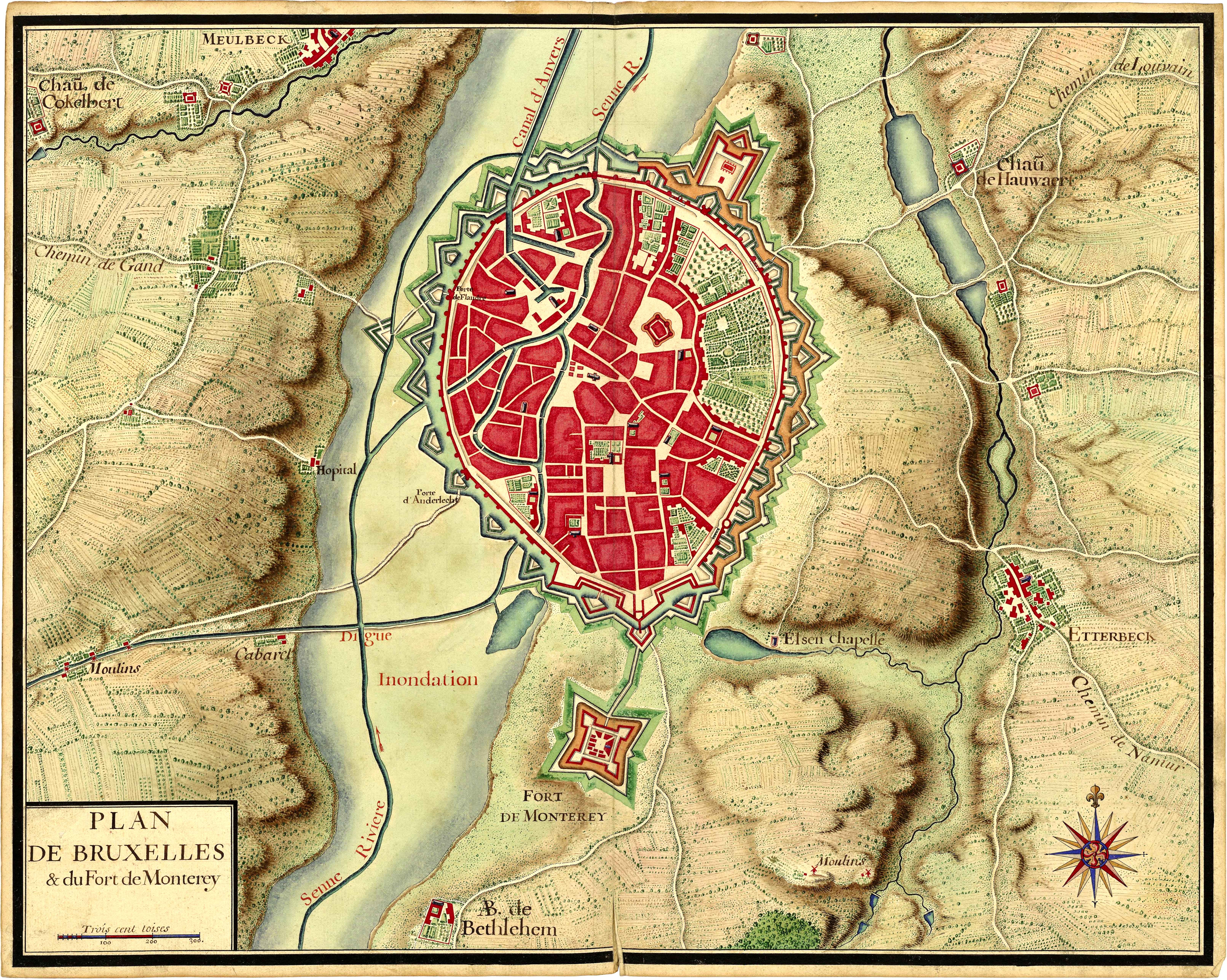
Français : Plan de Bruxelles provenant de la collection de cartes réunies pour Louis XIV lors de la guerre de succession d'Espagne (1701-1714). Extrait du Recueil de cartes des environs de plusieurs places et de parties de France, des Pays-Bas espagnols et hollandois, d'Allemagne, d'Autriche et d'Italie. |
||||
| Date | circa 1700 | ||||
| Source |
Bibliothèque nationale de France |
||||
| Author | Unknown author | ||||
| Permission (Reusing this file) |
|
| Camera location | | View this and other nearby images on: OpenStreetMap |
|---|
| This is a retouched picture, which means that it has been digitally altered from its original version. Modifications: Luminosity and constrast enhancement, stains and scratches on borders removed, slight global rotation.
|
Licensing
|
This work is in the public domain in its country of origin and other countries and areas where the copyright term is the author's life plus 100 years or fewer. | |
| This file has been identified as being free of known restrictions under copyright law, including all related and neighboring rights. | |
File history
Click on a date/time to view the file as it appeared at that time.
| Date/Time | Thumbnail | Dimensions | User | Comment | |
|---|---|---|---|---|---|
| current | 06:20, 7 October 2011 | | 6,447 × 5,151 (4.78 MB) | Benwik | {{Information |Description ={{fr|1=Plan de Bruxelles provenant de la collection de cartes réunies pour Louis XIV lors de la guerre de succession d'Espagne (1701-1714). Extrait du Recueil de cartes des environs de plusieurs places et de parties de Fran |
File usage
The following pages on the English Wikipedia use this file (pages on other projects are not listed):
Global file usage
The following other wikis use this file:
- Usage on fr.wikipedia.org
- Usage on id.wikipedia.org
- Usage on it.wikipedia.org
- Usage on nl.wikipedia.org
- Usage on sl.wikipedia.org