
File:Map of Auckland.jpg
No higher resolution available.
Map_of_Auckland.jpg (351 × 372 pixels, file size: 68 KB, MIME type: image/jpeg)
| This is a file from the Wikimedia Commons. Information from its description page there is shown below. Commons is a freely licensed media file repository. You can help. |
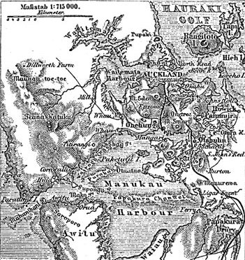
| Description | 1888 German map of Auckland, New Zealand |
| Date | |
| Source | 1888 Meyers Konversations-Lexikon |
| Author | Unknown author |
| This image comes from the 4th edition of Meyers Konversationslexikon (1885–90). The copyrights have expired and this image is in the public domain. |
|
This work is in the public domain in its country of origin and other countries and areas where the copyright term is the author's life plus 100 years or fewer. This work is in the public domain in the United States because it was published (or registered with the U.S. Copyright Office) before January 1, 1929. | |
| This file has been identified as being free of known restrictions under copyright law, including all related and neighboring rights. | |
File history
Click on a date/time to view the file as it appeared at that time.
| Date/Time | Thumbnail | Dimensions | User | Comment | |
|---|---|---|---|---|---|
| current | 14:29, 31 July 2005 | | 351 × 372 (68 KB) | Korg | 1888 German map of Auckland {{PD}} |
File usage
The following pages on the English Wikipedia use this file (pages on other projects are not listed):
Global file usage
The following other wikis use this file:
- Usage on de.wikipedia.org
- Usage on el.wikipedia.org
- Usage on eo.wikipedia.org
- Usage on es.wikipedia.org
- Usage on fr.wikipedia.org
- Usage on it.wikipedia.org
- Usage on mk.wikipedia.org
- Usage on nn.wikipedia.org
- Usage on no.wikipedia.org
- Usage on ru.wikipedia.org