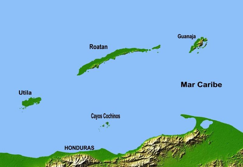
File:Mapa de Islas de la Bahia.JPG
Appearance

Size of this preview: 800 × 549 pixels. Other resolutions: 320 × 220 pixels | 640 × 439 pixels | 909 × 624 pixels.
Original file (909 × 624 pixels, file size: 45 KB, MIME type: image/jpeg)
File history
Click on a date/time to view the file as it appeared at that time.
| Date/Time | Thumbnail | Dimensions | User | Comment | |
|---|---|---|---|---|---|
| current | 16:38, 12 August 2013 |  | 909 × 624 (45 KB) | JVC3ETA | Better version of Bay Islands' map |
| 16:34, 12 August 2013 |  | 909 × 624 (45 KB) | JVC3ETA | A better version of Map of the Bay Islands | |
| 18:07, 2 February 2013 |  | 1,200 × 857 (51 KB) | JVC3ETA | New version of the same file with some minor changes. | |
| 04:25, 2 February 2013 |  | 1,200 × 857 (46 KB) | JVC3ETA | User created page with UploadWizard |
File usage
The following 4 pages use this file:
Global file usage
The following other wikis use this file:
- Usage on ast.wikipedia.org
- Usage on br.wikipedia.org
- Usage on es.wikipedia.org
- Usage on fa.wikipedia.org
- Usage on fr.wikipedia.org
- Usage on hr.wikipedia.org
- Usage on mt.wikipedia.org
- Usage on nl.wikipedia.org
- Usage on pl.wikipedia.org
- Usage on sh.wikipedia.org
- Usage on uk.wikipedia.org
