
File:Marquesas Keys.jpg
Size of this preview: 536 × 599 pixels. Other resolutions: 215 × 240 pixels | 429 × 480 pixels | 652 × 729 pixels.
Original file (652 × 729 pixels, file size: 109 KB, MIME type: image/jpeg)
| This is a file from the Wikimedia Commons. Information from its description page there is shown below. Commons is a freely licensed media file repository. You can help. |
Summary
| Description |
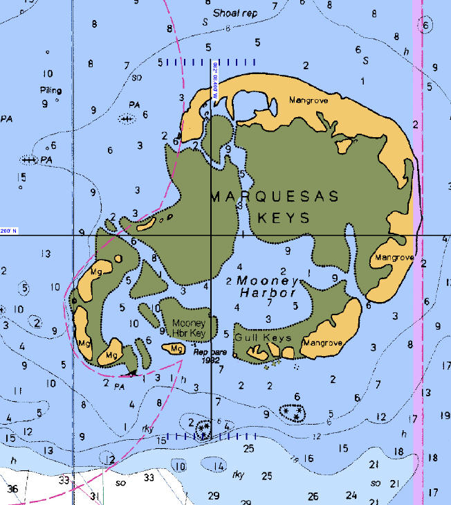
English: Map of Marquesas Keys, Florida. |
| Date | Unknown date |
| Source | Extracted from NOAA Nautical Chart 11439 "Sand Key to Rebecca Shoal" |
| Author | NOAA |
Licensing
This image is in the public domain because it contains materials that originally came from the U.S. National Oceanic and Atmospheric Administration, taken or made as part of an employee's official duties.
|
Original upload log
(All user names refer to en.wikipedia)
- 2006-05-06 20:38 Ratzer 652×729 (109 KB) (NOAA Nautical Chart 11439)
File history
Click on a date/time to view the file as it appeared at that time.
| Date/Time | Thumbnail | Dimensions | User | Comment | |
|---|---|---|---|---|---|
| current | 10:53, 8 December 2008 | | 652 × 729 (109 KB) | Telim tor | == Information == {{Information |Description=Map of Marquesas Keys, Florida. |Source=Extracted from NOAA Nautical Chart 11439 "Sand Key to Rebecca Shoal" |Date= |Author=NOAA |Permission= |other_versions= }} == License information == {{PD-USGov-NOAA}} == |
File usage
The following pages on the English Wikipedia use this file (pages on other projects are not listed):
Global file usage
The following other wikis use this file:
- Usage on de.wikipedia.org
- Usage on es.wikipedia.org
- Usage on fr.wikipedia.org
- Usage on www.wikidata.org
- Usage on zh.wikipedia.org