
File:Mawson station from the air.jpg
No higher resolution available.
Mawson_station_from_the_air.jpg (800 × 505 pixels, file size: 50 KB, MIME type: image/jpeg)
| This is a file from the Wikimedia Commons. Information from its description page there is shown below. Commons is a freely licensed media file repository. You can help. |
Summary
| Description |
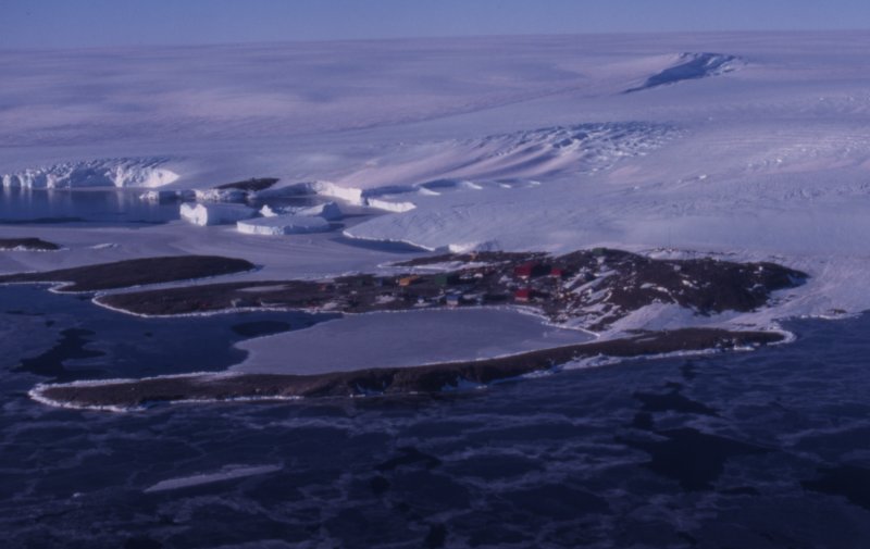
English: Mawson station from the air, showing Horseshoe Harbour. This is at the end of summer, and sea ice is beginning to re-form. |
| Date | 24 July 2004 (original upload date) |
| Source | Transferred from en.wikipedia to Commons. |
| Author | Rst at English Wikipedia |
| Camera location | | View this and other nearby images on: OpenStreetMap |
|---|
Licensing
| This file is licensed under the Creative Commons Attribution-Share Alike 3.0 Unported license. Subject to disclaimers. | ||
| ||
| This licensing tag was added to this file as part of the GFDL licensing update. |

|
Permission is granted to copy, distribute and/or modify this document under the terms of the GNU Free Documentation License, Version 1.2 or any later version published by the Free Software Foundation; with no Invariant Sections, no Front-Cover Texts, and no Back-Cover Texts. A copy of the license is included in the section entitled GNU Free Documentation License. Subject to disclaimers. |
Original upload log
The original description page was here. All following user names refer to en.wikipedia.
- 2004-07-24 03:51 Rst 800×505× (51153 bytes) Taken by User:rst, I own copyright. {{GFDL}}
File history
Click on a date/time to view the file as it appeared at that time.
| Date/Time | Thumbnail | Dimensions | User | Comment | |
|---|---|---|---|---|---|
| current | 15:53, 30 October 2005 | | 800 × 505 (50 KB) | Snowdog | '''Mawson station''' from the air, showing Horseshoe Harbour. This is at the end of summer, and sea ice is beginning to re-form. |
File usage
The following pages on the English Wikipedia use this file (pages on other projects are not listed):
Global file usage
The following other wikis use this file:
- Usage on ast.wikipedia.org
- Usage on az.wikipedia.org
- Usage on cs.wikipedia.org
- Usage on de.wikipedia.org
- Usage on es.wikipedia.org
- Usage on fr.wikipedia.org
- Usage on he.wikipedia.org
- Usage on it.wikipedia.org
- Usage on ka.wikipedia.org
- Usage on lb.wikipedia.org
- Usage on lt.wikipedia.org
- Usage on lv.wikipedia.org
- Usage on nn.wikipedia.org
- Usage on pl.wikipedia.org
- Usage on ru.wikipedia.org
- Usage on sv.wikipedia.org
- Usage on www.wikidata.org
- Usage on xmf.wikipedia.org
- Usage on zh.wikipedia.org