
File:Memorial Gardens (geograph 5531397).jpg

Size of this preview: 800 × 530 pixels. Other resolutions: 320 × 212 pixels | 640 × 424 pixels | 1,000 × 662 pixels.
Original file (1,000 × 662 pixels, file size: 740 KB, MIME type: image/jpeg)
| This is a file from the Wikimedia Commons. Information from its description page there is shown below. Commons is a freely licensed media file repository. You can help. |
.jpg)
Summary
| Description |
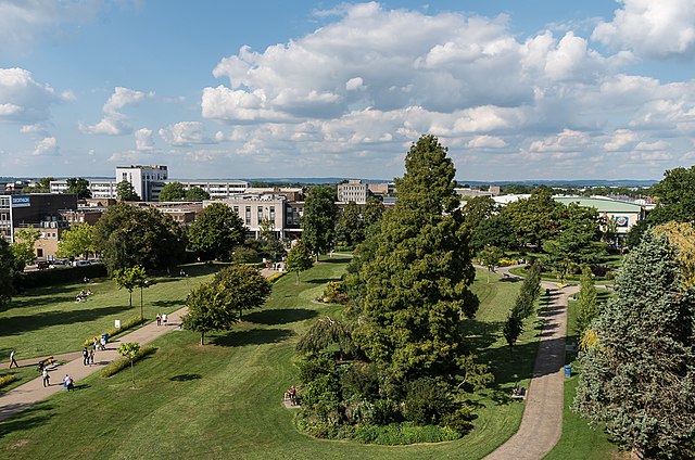
English: Green Flag park in central Crawley, originally purchased in 1921 using funds raised by the local community to serve as a public recreation ground in memory of those who had lost their lives during the Great War. Seen here from the car park of County Mall shopping centre.
In the far distance can be seen the line of the North Downs near Reigate. |
| Date | |
| Source | From geograph.org.uk |
| Author | Ian Capper |
| Permission (Reusing this file) |
Creative Commons Attribution Share-alike license 2.0 |
| Attribution (required by the license) | Ian Capper / Memorial Gardens / |
| Camera location | | View this and other nearby images on: OpenStreetMap |
|---|
.jpg¶ms=051.113915_N_-000.184577_E_globe:Earth_type:camera_source:geograph-osgb36(TQ2717136525)_heading:0.00&language=en)
| Object location | | View this and other nearby images on: OpenStreetMap |
|---|
.jpg¶ms=051.114380_N_-000.184590_E_globe:Earth_class:object_type:object_source:geograph-osgb36(TQ2716936577)_heading:0.00&language=en)
Licensing

|
This image was taken from the Geograph project collection. See this photograph's page on the Geograph website for the photographer's contact details. The copyright on this image is owned by Ian Capper and is licensed for reuse under the Creative Commons Attribution-ShareAlike 2.0 license.
|
This file is licensed under the Creative Commons Attribution-Share Alike 2.0 Generic license.
Attribution: Ian Capper
- You are free:
- to share – to copy, distribute and transmit the work
- to remix – to adapt the work
- Under the following conditions:
- attribution – You must give appropriate credit, provide a link to the license, and indicate if changes were made. You may do so in any reasonable manner, but not in any way that suggests the licensor endorses you or your use.
- share alike – If you remix, transform, or build upon the material, you must distribute your contributions under the same or compatible license as the original.
File history
Click on a date/time to view the file as it appeared at that time.
| Date/Time | Thumbnail | Dimensions | User | Comment | |
|---|---|---|---|---|---|
| current | 23:33, 14 February 2023 | | 1,000 × 662 (740 KB) | Chocolateediter | == {{int:filedesc}} == {{Information |Description={{en|1= Green Flag park in central Crawley, originally purchased in 1921 using funds raised by the local community to serve as a public recreation ground in memory of those who had lost their lives during the Great War. Seen here from the car park of County Mall shopping centre. In the far distance can be seen the line of the North Downs near Reigate.}} |Source=From [https://www.geograph.org.uk/photo/5531397 geograph.org.uk] |Date=2017-09-02... |
File usage
The following pages on the English Wikipedia use this file (pages on other projects are not listed):
.jpg)