
File:NPS yosemite-valley-rockfall-map.gif

Size of this preview: 800 × 469 pixels. Other resolutions: 320 × 188 pixels | 640 × 375 pixels | 1,024 × 600 pixels | 1,280 × 750 pixels | 2,560 × 1,500 pixels | 6,912 × 4,050 pixels.
Original file (6,912 × 4,050 pixels, file size: 7.28 MB, MIME type: image/gif, 0.1 s)
| This is a file from the Wikimedia Commons. Information from its description page there is shown below. Commons is a freely licensed media file repository. You can help. |
Summary
| Description |
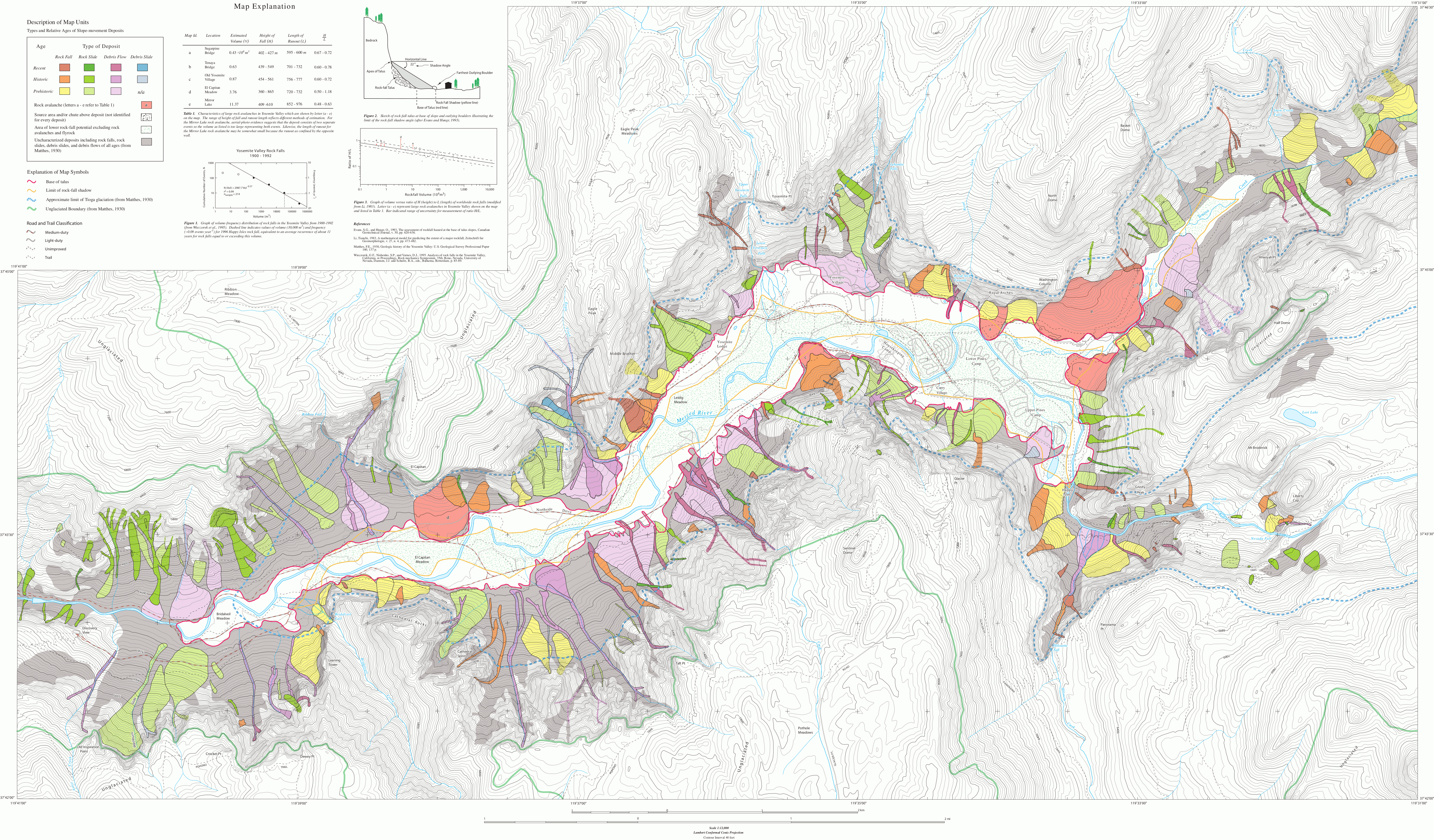
English: Yosemite Valley rockfall map, indicating the type of rockfall as well as location and known date of each one in Yosemite Valley. Rockfalls tend to be common in spring and winter. |
| Date | |
| Source | U.S. National Park Service (http://npmaps.com/wp-content/uploads/yosemite-valley-rockfall-map.gif) |
| Author | U.S. National Park Service, restoration/cleanup by Matt Holly |
Licensing
| This image or media file contains material based on a work of a National Park Service employee, created as part of that person's official duties. As a work of the U.S. federal government, such work is in the public domain in the United States. See the NPS website and NPS copyright policy for more information. |
File history
Click on a date/time to view the file as it appeared at that time.
| Date/Time | Thumbnail | Dimensions | User | Comment | |
|---|---|---|---|---|---|
| current | 10:25, 17 May 2017 | | 6,912 × 4,050 (7.28 MB) | RKBot | =={{int:filedesc}}== {{Information |description= {{en|1=Yosemite Valley rockfall map, indicating the type of rockfall as well as location and known date of each one in Yosemite Valley. Rockfalls tend to be common in spring and winter.}} |date= 2017-01-... |
File usage
The following page uses this file: