
File:NebraskaOmahaInCounty.png
No higher resolution available.
NebraskaOmahaInCounty.png (492 × 357 pixels, file size: 22 KB, MIME type: image/png)
| This is a file from the Wikimedia Commons. Information from its description page there is shown below. Commons is a freely licensed media file repository. You can help. |
Summary
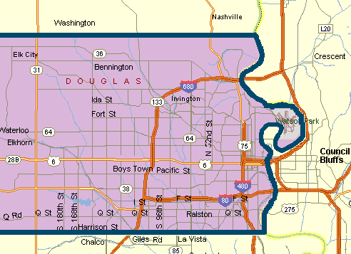
Map of Omaha, NE, area with Douglas County boundaries, showing major roads. Generated by the submitter, based on U.S. Census county maps and several road maps, with simplified detail and coloration chosen to emphasize the county.
Licensing
I, the copyright holder of this work, hereby publish it under the following license:
| This file is licensed under the Creative Commons Attribution-Share Alike 3.0 Unported license. Subject to disclaimers. | ||
| ||
| This licensing tag was added to this file as part of the GFDL licensing update. |

|
Permission is granted to copy, distribute and/or modify this document under the terms of the GNU Free Documentation License, Version 1.2 or any later version published by the Free Software Foundation; with no Invariant Sections, no Front-Cover Texts, and no Back-Cover Texts. A copy of the license is included in the section entitled GNU Free Documentation License. Subject to disclaimers. |
File history
Click on a date/time to view the file as it appeared at that time.
| Date/Time | Thumbnail | Dimensions | User | Comment | |
|---|---|---|---|---|---|
| current | 20:53, 15 April 2006 | | 492 × 357 (22 KB) | Craig Bolon | Map of Omaha, NE, area with Douglas County boundaries, showing major roads. Generated by the submitter, based on U.S. Census county maps and several road maps, with simplified detail and coloration chosen to emphasize the county. |
File usage
No pages on the English Wikipedia use this file (pages on other projects are not listed).