
File:New Zealand earthquake 2007.png
No higher resolution available.
New_Zealand_earthquake_2007.png (418 × 512 pixels, file size: 167 KB, MIME type: image/png)
| This is a file from the Wikimedia Commons. Information from its description page there is shown below. Commons is a freely licensed media file repository. You can help. |
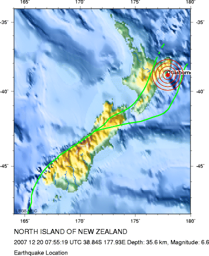
Summary
| Description | Map of location of earthquake off New Zealand on 20 December 2007 |
| Date | |
| Source | Magnitude 6.6 - NORTH ISLAND OF NEW ZEALAND |
| Author | U.S. Geological Survey, National Earthquake Information Center, World Data Center for Seismology, Denver |
Licensing
This image is in the public domain in the United States because it only contains materials that originally came from the United States Geological Survey, an agency of the United States Department of the Interior. For more information, see the official USGS copyright policy.
|
File history
Click on a date/time to view the file as it appeared at that time.
| Date/Time | Thumbnail | Dimensions | User | Comment | |
|---|---|---|---|---|---|
| current | 12:28, 21 December 2007 | | 418 × 512 (167 KB) | Canley | {{Information |Description=Map of location of earthquake off New Zealand on 20 December 2007 |Source=[http://neic.usgs.gov/neis/eq_depot/2007/eq_071220_ldas/neic_ldas_l.html Magnitude 6.6 - NORTH ISLAND OF NEW ZEALAND] |Date=20 December 2007 |Author=U.S. |
File usage
No pages on the English Wikipedia use this file (pages on other projects are not listed).