
File:O&C lands.png

Size of this preview: 387 × 599 pixels. Other resolutions: 155 × 240 pixels | 310 × 480 pixels | 496 × 768 pixels | 661 × 1,024 pixels | 1,578 × 2,443 pixels.
Original file (1,578 × 2,443 pixels, file size: 954 KB, MIME type: image/png)
| This is a file from the Wikimedia Commons. Information from its description page there is shown below. Commons is a freely licensed media file repository. You can help. |
Summary
| Description |
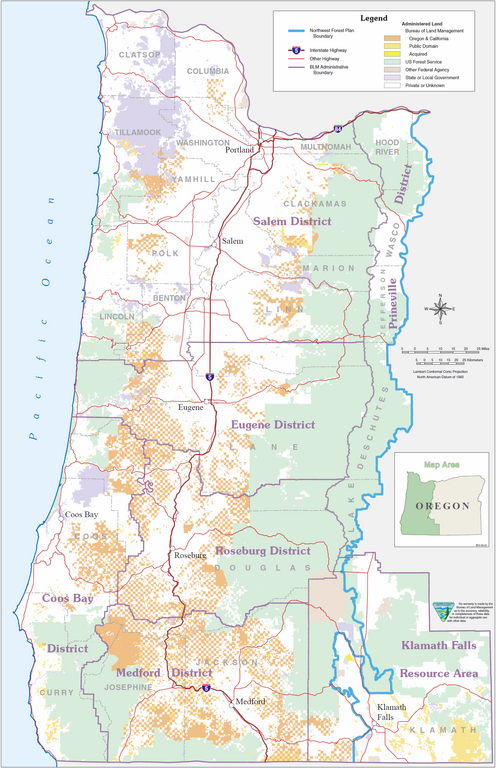
English: Map showing lands administered by the U.S. Bureau of Land Management in the western half of the state of Oregon. |
| Date | |
| Source | http://www.blm.gov/or/resources/forests/files/NW_ForestPlanMap.pdf |
| Author | Bureau of Land Management |
Licensing
| This image is a work of a Bureau of Land Management* employee, taken or made as part of that person's official duties. As a work of the U.S. federal government, the image is in the public domain in the United States. *or predecessor organization |
File history
Click on a date/time to view the file as it appeared at that time.
| Date/Time | Thumbnail | Dimensions | User | Comment | |
|---|---|---|---|---|---|
| current | 20:30, 15 February 2012 | | 1,578 × 2,443 (954 KB) | Esprqii |
File usage
The following pages on the English Wikipedia use this file (pages on other projects are not listed):