
File:Overstrand railway station, 2008 - geograph.org.uk - 757035.jpg
No higher resolution available.
Overstrand_railway_station,_2008_-_geograph.org.uk_-_757035.jpg (640 × 480 pixels, file size: 107 KB, MIME type: image/jpeg)
| This is a file from the Wikimedia Commons. Information from its description page there is shown below. Commons is a freely licensed media file repository. You can help. |
Summary
| Description |
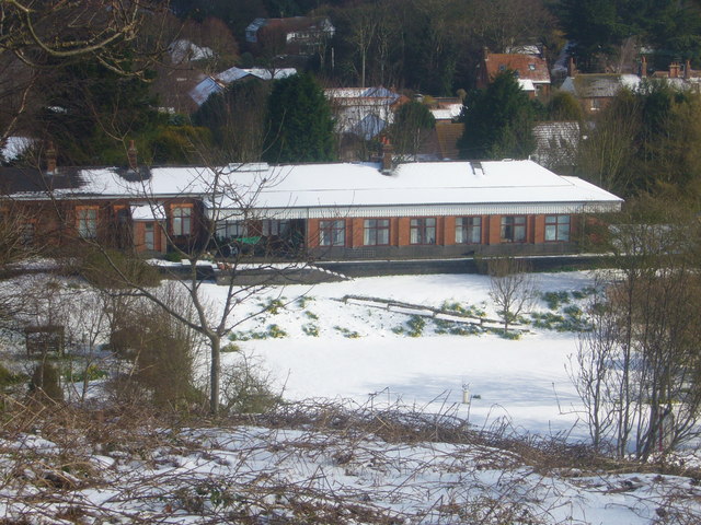
English: The Old Station Overstrand This station was on the Norfolk and Suffolk Joint Railway line from Cromer to North Walsham via Mundesley on Sea. It was owned and run by the Great Eastern Railway company (GER) and the Midland and Great Northern Railway company (M&GN). Both were rivals but on this line and the Lowestoft to Great Yarmouth line they worked together. The station and line closed in 1953 after flood damage. |
| Date | Taken on 25 March 2008 |
| Source | From geograph.org.uk; transferred by User:oxyman using geograph_org2commons. |
| Author | Hughie Watts |
| Permission (Reusing this file) |
Creative Commons Attribution Share-alike license 2.0 |
| Camera location | | View this and other nearby images on: OpenStreetMap |
|---|
| Object location | | View this and other nearby images on: OpenStreetMap |
|---|
_region:GB-GBN_heading:22.00&language=en)
Licensing

|
This image was taken from the Geograph project collection. See this photograph's page on the Geograph website for the photographer's contact details. The copyright on this image is owned by Hughie Watts and is licensed for reuse under the Creative Commons Attribution-ShareAlike 2.0 license.
|
This file is licensed under the Creative Commons Attribution-Share Alike 2.0 Generic license.
Attribution: Hughie Watts
- You are free:
- to share – to copy, distribute and transmit the work
- to remix – to adapt the work
- Under the following conditions:
- attribution – You must give appropriate credit, provide a link to the license, and indicate if changes were made. You may do so in any reasonable manner, but not in any way that suggests the licensor endorses you or your use.
- share alike – If you remix, transform, or build upon the material, you must distribute your contributions under the same or compatible license as the original.
File history
Click on a date/time to view the file as it appeared at that time.
| Date/Time | Thumbnail | Dimensions | User | Comment | |
|---|---|---|---|---|---|
| current | 01:34, 2 November 2009 | | 640 × 480 (107 KB) | File Upload Bot (Magnus Manske) | == Summary == {{Information |Description=The Old Station Overstrand |Source=From [http://www.geograph.org.uk/photo/757035 geograph.org.uk]; transferd by User:oxyman using [http://toolserver.org/~magnus/geograph_org2commons.php geograph_org2commons]. | |
File usage
The following pages on the English Wikipedia use this file (pages on other projects are not listed):
Global file usage
The following other wikis use this file:
- Usage on www.wikidata.org