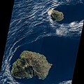
File:Prince Edward Island, South Africa, EO-1 ALI satellite image, 5 May 2009.jpg
Appearance

Size of this preview: 767 × 599 pixels. Other resolutions: 307 × 240 pixels | 614 × 480 pixels | 983 × 768 pixels | 1,280 × 1,000 pixels | 1,455 × 1,137 pixels.
Original file (1,455 × 1,137 pixels, file size: 429 KB, MIME type: image/jpeg)
File history
Click on a date/time to view the file as it appeared at that time.
| Date/Time | Thumbnail | Dimensions | User | Comment | |
|---|---|---|---|---|---|
| current | 09:19, 5 April 2011 |  | 1,455 × 1,137 (429 KB) | Avenue | {{Information |Description ={{en|1=Satellite image of South Africa's Prince Edward Island.}} |Source =[http://earthobservatory.nasa.gov/images/imagerecords/40000/40806/princeedwardis_ali_2009125_lrg.jpg Image] (here cropped) and [http://earthob |
File usage
The following page uses this file:
Global file usage
The following other wikis use this file:
- Usage on af.wikipedia.org
- Usage on be.wikipedia.org
- Usage on ceb.wikipedia.org
- Usage on cs.wikipedia.org
- Usage on da.wikipedia.org
- Usage on de.wikipedia.org
- Usage on el.wikipedia.org
- Usage on es.wikipedia.org
- Usage on fr.wikivoyage.org
- Usage on ja.wikipedia.org
- Usage on lv.wikipedia.org
- Usage on nl.wikipedia.org
- Usage on nn.wikipedia.org
- Usage on pl.wikipedia.org
- Usage on www.wikidata.org
- Usage on zh.wikipedia.org


