
File:QuartiersElMenzah ElManar TunisNord.JPG
Size of this preview: 800 × 600 pixels. Other resolutions: 320 × 240 pixels | 640 × 480 pixels | 1,024 × 768 pixels | 1,280 × 960 pixels | 2,560 × 1,920 pixels | 3,264 × 2,448 pixels.
Original file (3,264 × 2,448 pixels, file size: 2.45 MB, MIME type: image/jpeg)
| This is a file from the Wikimedia Commons. Information from its description page there is shown below. Commons is a freely licensed media file repository. You can help. |
Summary
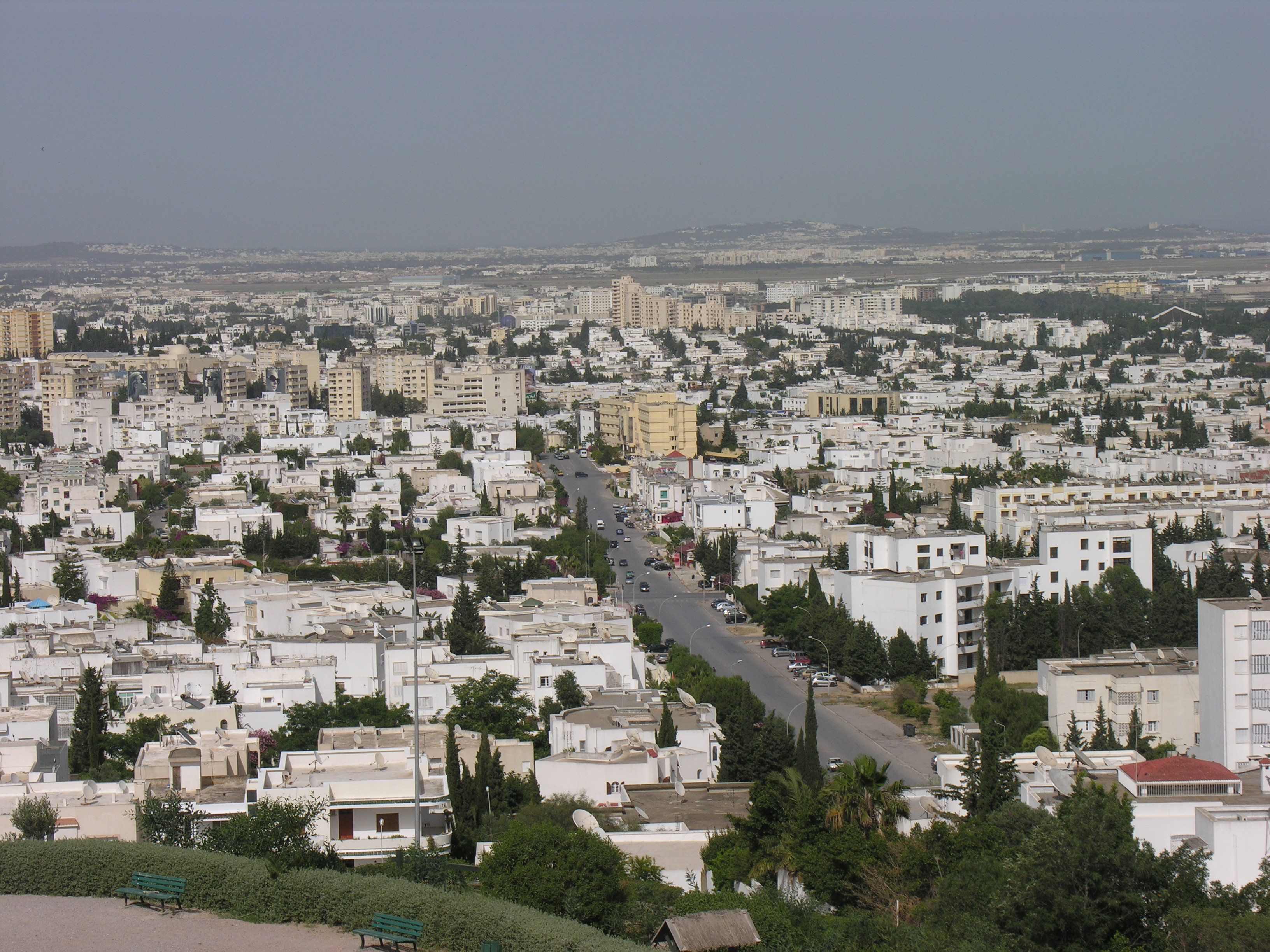
| Description | Les quartiers d'El Menzah et d'El Manar dans la banlieue nord de Tunis. En haut et dans la zone verte, on voit l'aéroport de Tunis-Carthage entourée par les quartiers d'El Aouina et La Soukra. Au fond de la photo, on aperçoit, de gauche à droite, les collines de Ghammarth, La Marsa-Sidi Bou Said et de Carthage. Au milieu, on aperçoit l'avenue qui mène d'El Menzah VI à El Manar. |
| Date | |
| Source | Own work |
| Author | Citizen59 |
Licensing
I, the copyright holder of this work, hereby publish it under the following licenses:

|
Permission is granted to copy, distribute and/or modify this document under the terms of the GNU Free Documentation License, Version 1.2 or any later version published by the Free Software Foundation; with no Invariant Sections, no Front-Cover Texts, and no Back-Cover Texts. A copy of the license is included in the section entitled GNU Free Documentation License. |
This file is licensed under the Creative Commons Attribution-Share Alike 3.0 Unported license.
- You are free:
- to share – to copy, distribute and transmit the work
- to remix – to adapt the work
- Under the following conditions:
- attribution – You must give appropriate credit, provide a link to the license, and indicate if changes were made. You may do so in any reasonable manner, but not in any way that suggests the licensor endorses you or your use.
- share alike – If you remix, transform, or build upon the material, you must distribute your contributions under the same or compatible license as the original.
You may select the license of your choice.
File history
Click on a date/time to view the file as it appeared at that time.
| Date/Time | Thumbnail | Dimensions | User | Comment | |
|---|---|---|---|---|---|
| current | 22:03, 31 May 2008 | | 3,264 × 2,448 (2.45 MB) | Citizen59 | {{Information |Description=Les quartiers d'El Menzah et d'El Manar dans la banlieue nord de Tunis. Au fond de la photo, on aperçoit, de gauche à droite, les collines de Ghammarth, La Marsa-Sidi Bou Said et de Carthage. |Source=travail personnel |Date=31 |
File usage
No pages on the English Wikipedia use this file (pages on other projects are not listed).
Global file usage
The following other wikis use this file:
- Usage on cs.wikipedia.org
- Usage on he.wikipedia.org
- Usage on ka.wikipedia.org
- Usage on sv.wikipedia.org
- Usage on szl.wikipedia.org
- Usage on tr.wikipedia.org
- Usage on zh-yue.wikipedia.org