
File:Schwarzsee.jpg
Size of this preview: 800 × 600 pixels. Other resolutions: 320 × 240 pixels | 640 × 480 pixels | 1,024 × 768 pixels | 1,280 × 960 pixels | 2,048 × 1,536 pixels.
Original file (2,048 × 1,536 pixels, file size: 1.27 MB, MIME type: image/jpeg)
| This is a file from the Wikimedia Commons. Information from its description page there is shown below. Commons is a freely licensed media file repository. You can help. |
| Description |
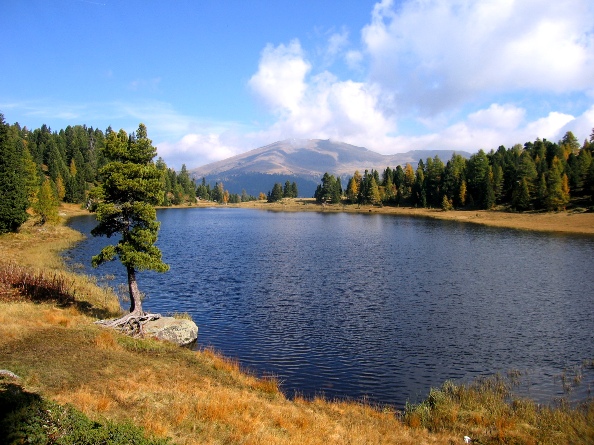
English: Lake Schwarzsee in the Nockberge mountain range near Turracher Höhe at the border between Carinthia and Styria / Austria / EU. The Styrian mountains in the background are Eisenhut and Wintertalernock.
Deutsch: Der Schwarzsee auf der Turracher Höhe im an der Grenze zwischen den österreichischen Bundesländern Kärnten und Steiermark. Die Berge im Hintergrund liegen in der Steiermark und sind der Eisenhut (2.441 m) und rechts der Wintertalernock (2.394 m). Im Vordergrund eine gebietstypische Zirbe, rechts und links vom See Zirben und Lärchen.
Français : Schwarzsee (lac noir), dans les Alpes autrichiennes. |
| Date | |
| Source | Own work |
| Author | Kmarka |
| Permission (Reusing this file) |
GFDL |
| Camera location | | View this and other nearby images on: OpenStreetMap |
|---|
I, the copyright holder of this work, hereby publish it under the following licenses:

|
Permission is granted to copy, distribute and/or modify this document under the terms of the GNU Free Documentation License, Version 1.2 or any later version published by the Free Software Foundation; with no Invariant Sections, no Front-Cover Texts, and no Back-Cover Texts. A copy of the license is included in the section entitled GNU Free Documentation License. |
| This file is licensed under the Creative Commons Attribution-Share Alike 3.0 Unported license. | ||
| ||
| This licensing tag was added to this file as part of the GFDL licensing update. |
You may select the license of your choice.
|

This image was selected as picture of the day on Wikimedia Commons for 10 March 2007. It was captioned as follows: English: Turracher Schwarzsee (Austria) Other languages:
Čeština: Jezero Turracher Schwarzsee Rakousko Cymraeg: Turracher Schwarzsee (Llyn Du Turrach), Awstria. Deutsch: Turracher Schwarzsee Turracher Höhe English: Turracher Schwarzsee (Austria) Español: Turracher Schwarzsee (Austria) Esperanto: Schwarzsee (Aŭstrio) Français : Schwarzsee (Autriche). Italiano: Schwarzsee (Austria) Magyar: Turracher Schwarzsee (Ausztria) Nederlands: Turachse meer in Oostenrijk Polski: Turracher Schwarzsee w Austrii. Sicilianu: Schwarzsee (Àustria) Slovenčina: Turracher Schwarzsee (Rakúsko) Suomi: Turracher Schwarzsee -vuoristojärvi Itävallassa Svenska: Schwarzsee (Österrike). Türkçe: Schwarzsee (Avusturya). Қазақша: Шварцзее көлі (Аустрия) Українська: Озеро Туррахер Шварцзее (Австрія) 日本語: トゥーラッハ湖 (オーストリア) |
File history
Click on a date/time to view the file as it appeared at that time.
| Date/Time | Thumbnail | Dimensions | User | Comment | |
|---|---|---|---|---|---|
| current | 13:04, 8 July 2006 | | 2,048 × 1,536 (1.27 MB) | Kmarka | Schwarzsee Turracher HöheCategory:Landschaft |
File usage
The following pages on the English Wikipedia use this file (pages on other projects are not listed):
Global file usage
The following other wikis use this file:
- Usage on ba.wikipedia.org
- Usage on de.wikipedia.org
- Usage on el.wikipedia.org
- Usage on es.wikipedia.org
- Usage on et.wikipedia.org
- Usage on fr.wikipedia.org
- Usage on fr.wiktionary.org
- Usage on he.wikipedia.org
- Usage on hu.wikipedia.org
- Usage on ia.wikipedia.org
- Usage on it.wikipedia.org
- Usage on kk.wikipedia.org
- Usage on ko.wikipedia.org
- Usage on os.wikipedia.org
- Usage on pl.wikipedia.org
- Usage on pt.wikipedia.org
- Usage on pt.wiktionary.org
- Usage on ru.wikipedia.org
- Usage on ru.wikinews.org
- Usage on sg.wiktionary.org
- Usage on sr.wikipedia.org
- Usage on sv.wikipedia.org
- Usage on uk.wikipedia.org
- Usage on vi.wikipedia.org
View more global usage of this file.