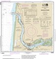
File:Siuslaw River, NOAA Navigation Chart No. 18583.pdf
Appearance

Size of this JPG preview of this PDF file: 571 × 599 pixels. Other resolutions: 229 × 240 pixels | 457 × 480 pixels | 732 × 768 pixels | 976 × 1,024 pixels | 1,951 × 2,048 pixels | 2,939 × 3,085 pixels.
Original file (2,939 × 3,085 pixels, file size: 1.19 MB, MIME type: application/pdf)
File history
Click on a date/time to view the file as it appeared at that time.
| Date/Time | Thumbnail | Dimensions | User | Comment | |
|---|---|---|---|---|---|
| current | 20:49, 22 April 2020 |  | 2,939 × 3,085 (1.19 MB) | Grand'mere Eugene | Uploaded a work by U. S. National Oceanic and Atmospheric Administration | from https://charts.noaa.gov/PDFs/18583.pdf with UploadWizard |
File usage
The following page uses this file:

