
File:Somalia pol02.jpg

Size of this preview: 500 × 599 pixels. Other resolutions: 200 × 240 pixels | 400 × 480 pixels | 641 × 768 pixels | 1,078 × 1,292 pixels.
Original file (1,078 × 1,292 pixels, file size: 698 KB, MIME type: image/jpeg)
| This is a file from the Wikimedia Commons. Information from its description page there is shown below. Commons is a freely licensed media file repository. You can help. |
Summary
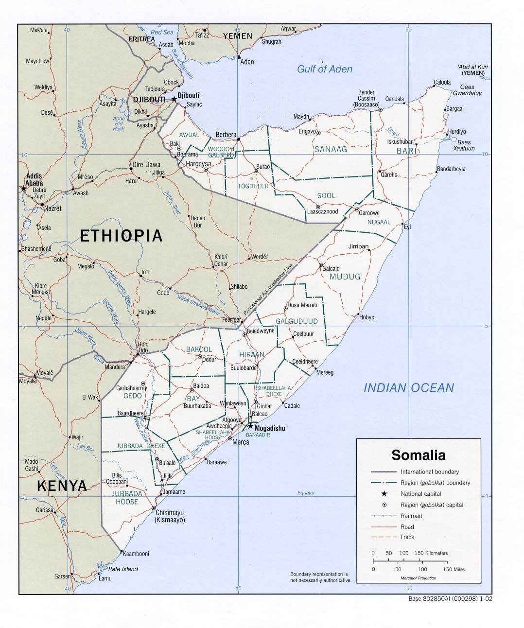
Perry-Castañeda Library - Political map of Somalia.
According to the source's table of contents, this is a CIA map, thus placing the image in the public domain.
Licensing
| This image is a work of a Central Intelligence Agency employee, taken or made as part of that person's official duties. As a Work of the United States Government, this image or media is in the public domain in the United States.
|

|
File history
Click on a date/time to view the file as it appeared at that time.
| Date/Time | Thumbnail | Dimensions | User | Comment | |
|---|---|---|---|---|---|
| current | 17:55, 16 March 2019 | | 1,078 × 1,292 (698 KB) | Goran tek-en | Changed Giohar to Jowhar and added Adado as requested by {{u|Buckshot06}} |
| 07:47, 14 December 2005 |  | 1,078 × 1,292 (202 KB) | Gyrofrog | Political map of Somalia.<br /> According to the source's [http://www.lib.utexas.edu/maps/somalia.html table of contents], this is a CIA map, thus placing the image in the public domain. |
File usage
The following pages on the English Wikipedia use this file (pages on other projects are not listed):
Global file usage
The following other wikis use this file:
- Usage on ast.wikipedia.org
- Usage on bg.wikipedia.org
- Usage on ckb.wikipedia.org
- Usage on fa.wikipedia.org
- Usage on fi.wikipedia.org
- Usage on id.wikipedia.org
- Usage on ja.wikipedia.org
- Usage on lt.wikipedia.org
- Usage on mzn.wikipedia.org
- Usage on nl.wikipedia.org
- Usage on ru.wikipedia.org
- Usage on sk.wikipedia.org
- Usage on tg.wikipedia.org
- Usage on uk.wikipedia.org