
File:Southern cameroons.PNG
Size of this preview: 402 × 600 pixels. Other resolutions: 161 × 240 pixels | 500 × 746 pixels.
Original file (500 × 746 pixels, file size: 25 KB, MIME type: image/png)
| This is a file from the Wikimedia Commons. Information from its description page there is shown below. Commons is a freely licensed media file repository. You can help. |
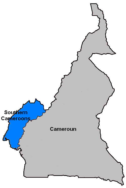
Summary
| Description | Southern Cameroons Territory in relation to the Republic of Cameroon. |
| Date | |
| Source | File:Cameroon provinces blank.png |
| Author | User:Golbez, modified by User:Scolaire. |
Licensing
| I, the copyright holder of this work, release this work into the public domain. This applies worldwide. In some countries this may not be legally possible; if so: I grant anyone the right to use this work for any purpose, without any conditions, unless such conditions are required by law. |
File history
Click on a date/time to view the file as it appeared at that time.
| Date/Time | Thumbnail | Dimensions | User | Comment | |
|---|---|---|---|---|---|
| current | 22:02, 5 October 2006 | | 500 × 746 (25 KB) | Scolaire | Slight modification (change 'Cameroon' to Cameroun') |
| 16:09, 13 August 2006 |  | 500 × 746 (25 KB) | Scolaire | Southern Cameroons Territory in relation to the Republic of Cameroon. From an original map by User:Golbez, modified by me. Category:Maps of Cameroon |
File usage
The following pages on the English Wikipedia use this file (pages on other projects are not listed):
Global file usage
The following other wikis use this file:
- Usage on ast.wikipedia.org
- Usage on ca.wikipedia.org
- Usage on es.wikipedia.org
- Usage on fi.wikipedia.org
- Usage on gl.wikipedia.org
- Usage on id.wikipedia.org
- Usage on it.wikipedia.org
- Usage on ja.wikipedia.org
- Usage on ko.wikipedia.org
- Usage on nl.wikipedia.org
- Usage on pl.wikipedia.org
- Usage on pt.wikipedia.org
- Usage on simple.wikipedia.org
- Usage on ur.wikipedia.org
- Usage on zh.wikipedia.org