
File:Stadtentwicklung vor 10 Jahrhundert 04.jpg
Size of this preview: 395 × 599 pixels. Other resolutions: 158 × 240 pixels | 316 × 480 pixels | 937 × 1,422 pixels.
Original file (937 × 1,422 pixels, file size: 310 KB, MIME type: image/jpeg)
| This is a file from the Wikimedia Commons. Information from its description page there is shown below. Commons is a freely licensed media file repository. You can help. |
Summary
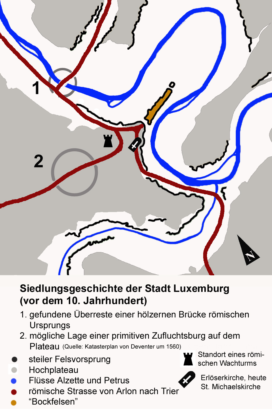
| Description | Early settlements in Luxembourg City. German version |
| Date | |
| Source |
|
| Author | user:Spanish_Inquisition |
| Permission (Reusing this file) |
GNU |
| Other versions | english version:Image:Early settlements in LuxbrgCity-english.jpg |
Licensing

|
Permission is granted to copy, distribute and/or modify this document under the terms of the GNU Free Documentation License, Version 1.2 or any later version published by the Free Software Foundation; with no Invariant Sections, no Front-Cover Texts, and no Back-Cover Texts. A copy of the license is included in the section entitled GNU Free Documentation License. |
| This file is licensed under the Creative Commons Attribution-Share Alike 3.0 Unported license. | ||
| ||
| This licensing tag was added to this file as part of the GFDL licensing update. |
File history
Click on a date/time to view the file as it appeared at that time.
| Date/Time | Thumbnail | Dimensions | User | Comment | |
|---|---|---|---|---|---|
| current | 15:35, 14 September 2006 | | 937 × 1,422 (310 KB) | Spanish Inquisition | {{Information |Description=Early settlements in Luxembourg City. '''German version''' |Source='''Sources''': *Image of the map by myself. *Positions of the roads and buidlings from "Der Wenzelrundweg. Ein kulturhistorischer Rundgang des Europarates durch |
File usage
The following pages on the English Wikipedia use this file (pages on other projects are not listed):