
File:Sweden Gotland location map.svg

Size of this PNG preview of this SVG file: 330 × 599 pixels. Other resolutions: 132 × 240 pixels | 264 × 480 pixels | 423 × 768 pixels | 564 × 1,024 pixels | 1,128 × 2,048 pixels | 551 × 1,000 pixels.
Original file (SVG file, nominally 551 × 1,000 pixels, file size: 63 KB)
| This is a file from the Wikimedia Commons. Information from its description page there is shown below. Commons is a freely licensed media file repository. You can help. |
Summary
| Description |
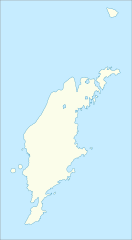
English: Location map of Gotland County in Sweden. N-S stretching is 187%, geographic limits of the map:
Deutsch: Positionskarte von Gotlands län in Schweden. N-S-Streckung beträgt 187%, geographische Begrenzung der Karte:
|
| Date | |
| Source | Own work |
| Author | Erik Frohne |
Licensing
I, the copyright holder of this work, hereby publish it under the following licenses:

|
Permission is granted to copy, distribute and/or modify this document under the terms of the GNU Free Documentation License, Version 1.2 or any later version published by the Free Software Foundation; with no Invariant Sections, no Front-Cover Texts, and no Back-Cover Texts. A copy of the license is included in the section entitled GNU Free Documentation License. |
This file is licensed under the Creative Commons Attribution-Share Alike 3.0 Unported license.
- You are free:
- to share – to copy, distribute and transmit the work
- to remix – to adapt the work
- Under the following conditions:
- attribution – You must give appropriate credit, provide a link to the license, and indicate if changes were made. You may do so in any reasonable manner, but not in any way that suggests the licensor endorses you or your use.
- share alike – If you remix, transform, or build upon the material, you must distribute your contributions under the same or compatible license as the original.
You may select the license of your choice.
File history
Click on a date/time to view the file as it appeared at that time.
| Date/Time | Thumbnail | Dimensions | User | Comment | |
|---|---|---|---|---|---|
| current | 08:32, 27 January 2009 | | 551 × 1,000 (63 KB) | Erik Frohne | Adjusted waterline |
| 08:30, 27 January 2009 |  | 551 × 1,000 (63 KB) | Erik Frohne | Adjusted waterline | |
| 15:46, 18 January 2009 |  | 551 × 1,000 (63 KB) | Erik Frohne | Added the major lakes Category:Location maps of Sweden | |
| 16:01, 14 January 2009 |  | 551 × 1,000 (60 KB) | Erik Frohne | {{Information |Description={{en|1=Location map of Gotland in Sweden. Geographic limits of the map: * N: 58.45° N * S: 56.80° N * W: 17.80° E * E: 19.50° E }} {{de|1=Positionskarte von Gotland in Schweden. Geographische Begrenzung der Karte: * N: 58.45 |
File usage
The following pages on the English Wikipedia use this file (pages on other projects are not listed):
Global file usage
The following other wikis use this file:
- Usage on ar.wikipedia.org
- Usage on bg.wikipedia.org
- Usage on ceb.wikipedia.org
- Usage on da.wikipedia.org
- Usage on de.wikipedia.org
- Visby
- Fårö
- Gotska Sandön
- Lövsta
- Stora Karlsö
- Lilla Karlsö
- Klintehamn
- Burgsvik
- Fårösund
- Hemse
- Bäste träsk
- Slite
- Vibble
- Lärbro
- Ljugarn
- Dalhem (Gotland)
- Flughafen Visby
- Paviken (See)
- Wikipedia:Kartenwerkstatt/Positionskarten/Europa
- När
- Tingstäde
- Väskinde
- Havdhem
- Västerhejde
- Vorlage:Positionskarte Schweden Gotland
- Naturschutzgebiet Brucebo
- Gräberfeld von Barshalder
- Tingstädeträsk
View more global usage of this file.